|
Portugal
|
|
|
There are many
places in Portugal which are interesting seen from a geographical point of
view.
For
example
– Olivença/Olivenza region, where Portugal and Spain never agreed on
the border.
Link:
http://www.olivenca.org/litigio_uk.htm
– Rio de Onor/Rihonor de Castilla, which form practically the same village
divided by the border and inhabitants own fields on the opposite side of the
border.
Link (Rio de Onor):
– Barrancos, a big 'finger' into Spanish territory with a peculiar dialect
(barranquenho).
Link:
http://en.wikipedia.org/wiki/Barrancos |
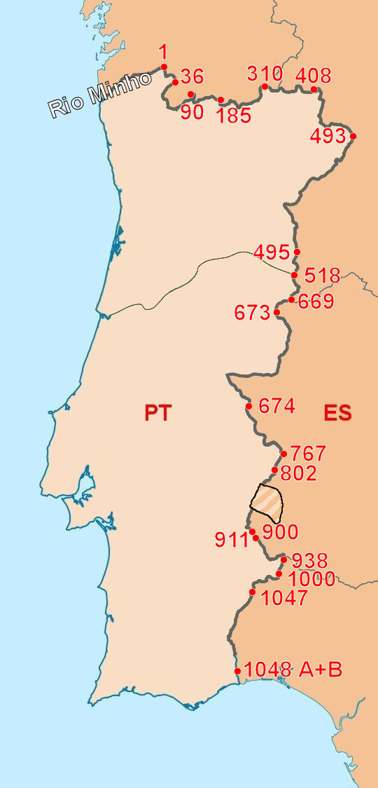
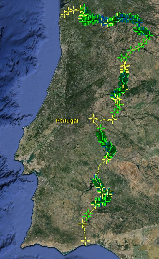
|
Below are some
border scenes from the Portuguese-Spanish border
commented and photographed by Mr. António
Callixto
All these photos feature the Portuguese/Spanish border in the Northwestern
part of Portugal (Guarda district). The "Pedra Ratchada" exact
location is in the parish (freguesia) of Foios, county (concelho) of Sabugal,
bordering the Spanish county (ayuntamiento) of Valverde del Fresno, at 40º
15,5938' North Latitude and 6º 52,5750 West Longitude.
|
 |
| We see two
roadways, one on each side of the border.
|
|
 |
|
| The two roadways
are clearer seen.
|
|
 |
|
| Detail
of a border marking stone, with E (España/Spain) on one side and P
(Portugal) on the other.
|
|
 |
|
| My
brother, my wife and myself are on the Spanish side of the border. You
can see border marker 669 (these stone markers are numbered all along
the Portuguese/Spanish border with fee exceptions). "Pedra Ratchada"
(this is a rough phonetical transcription of the local pronunciation,
since in standard Portuguese it should be written "Pedra Rachada")
means litteraly "broken stone". As you see the stone has been
broken by natural phenomena (erosion, low temperatures, etc.) as if it
wanted to mark the exact border.
|
|
 |
|
| More detailed
views of the same stone.
|
|
 |
|
| More detailed
views of the same stone.
|
|
 |
|
| The former Spanish custom
station at Calabor, now abandoned (the
border post on the Portuguese side is Portelo).
All the pictures below are from locations
in the North and Northwestern part of Portugal). |
|
 |
|
| Border
markers at Rio de Onor. The small river marks the border and the bridge
goes from one country to the other. Rio de Onor/Rihonor de Castilla form
practically the same village divided by the border and several
inhabitants own fields in the neihbouring country.
|
|
 |
|
| Entering
Portugal by a countryside road near Lajeosa.
|
|
 |
|
| Border marker between Rio de Onor
(Portugal) and Rihonor de Castilla (Spain.
This page was last time updated 21/03/10
. |
|