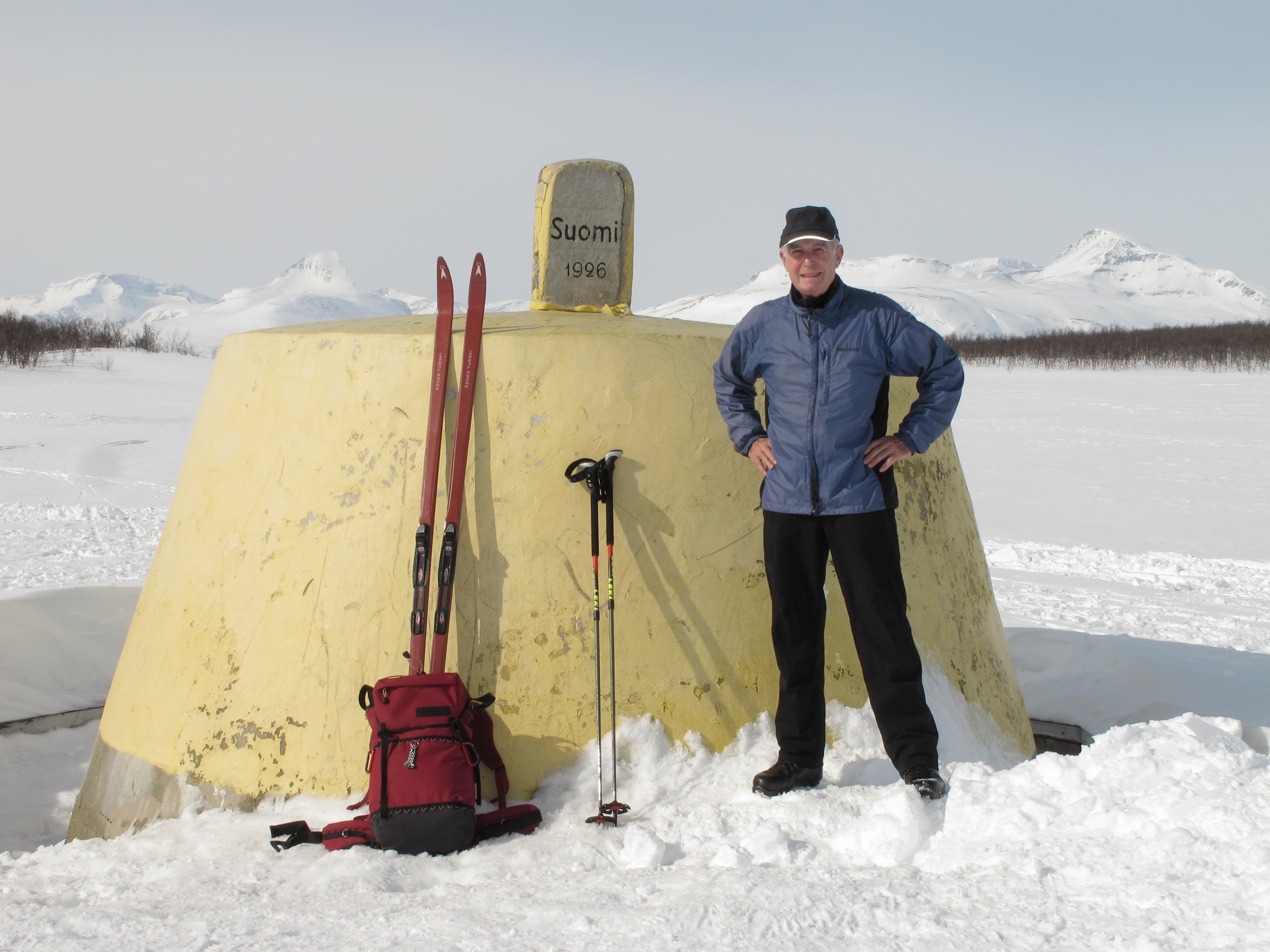
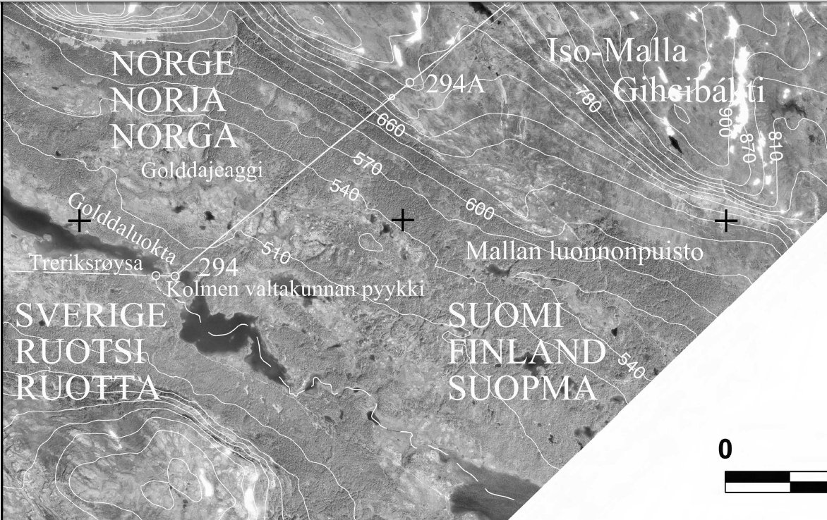
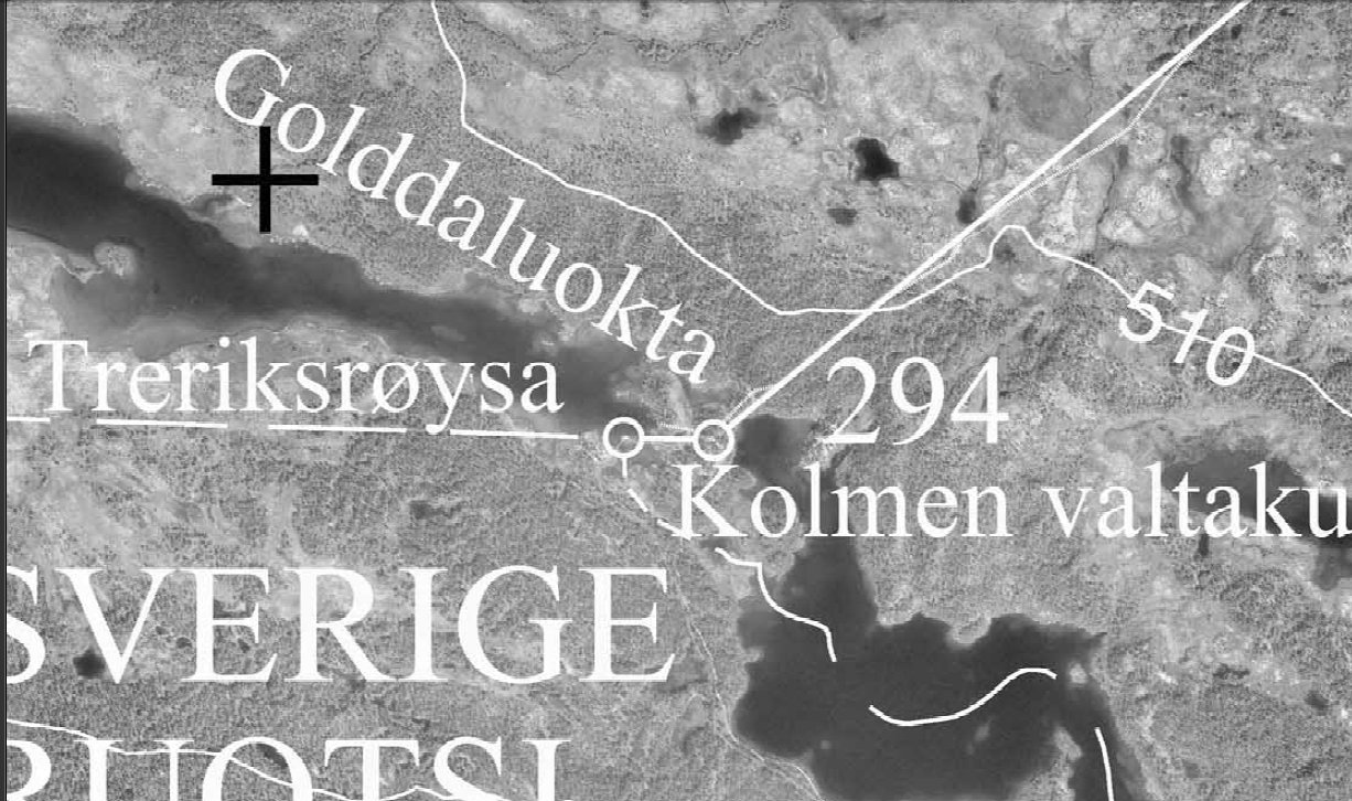
The trifinium Finland - Norway - Sweden
The
FINOSE trifinium (or tripoint) marker is located on the Norwegian boundary between
boundary middle marker 293 Aa and boundary marker 294 in Lake
Golddajávri. The marker itself does not have any number, but is often
called "293A" or "293B", although this assignment was never was given. In
Norwegian language it is only called Treriksrøysa (lit. "Three
countries' cairn").
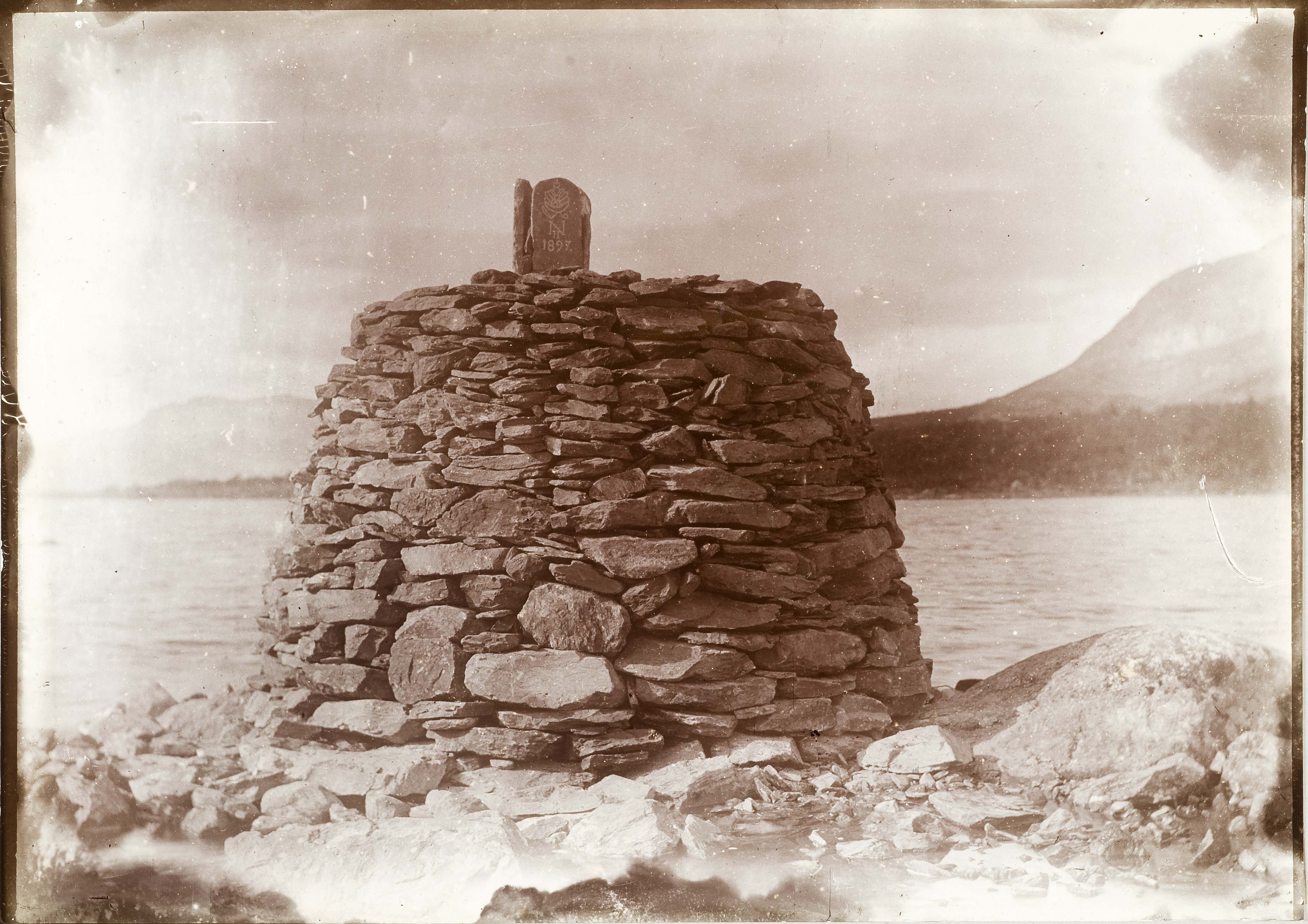
In 1897 a cairn was raised on the Norwegian - Russian border at
Golddajávri. (Finland was then a part of Russia). The trifinium is making
the final end of a valley beginning in the end of the Lyngen Fjord.
Sweden ceded Finland to Russia in 1809.
Five years later, in 1814, the Dano-Norwegian Union ended and by the end
of the same year Norway and Sweden came under one king.
The last part of the Norwegian-Russian boundary, the leg from about Polmak
to Grense Jakobselv River, was demarcated in 1826. Finland
declared her independence from Russia in 1917 and the boundary was again
demarcated in 1920, both times without change of boundary cairn location.
A minor modification of the trifinium cairn occured in 1926, and
"1926" was engraved on the top stone ("heart stone") into
Finnish side. On Norwegian and Swedish side it says 1901, which is the year when the
heart stone was erected. In 1926 the cairn was brushed down, later the upper part
was painted yellow.
The best way to reach the point is from Finnish side. In
summer a taxi boat is taking you from the small boat harbour at Siilastupa
near the village of Kilpisjävri across Lake Kilpisjävri to Koltaluokta
at Swedish side of the lake. From this point it is about 3 kilometres to
walk to the trifinium. In summer the taxi boat sails from Siilastupa
three times a day, at 10 AM, 2 PM and 6 PM.
FINOSE is the northernmost trifinium in the
world, being only a few hundred metres ahead of FINORU!
Acknowledgments
Many
thanks to Mr Trond E. Espelund of the Norwegian Mapping
Authority (Statkart) and Mr Richard Montague for
providing us the very valuable and historical images from the 1897 Border
Commision.
The
1901 map is published in Åke Gustafsson's book "Riksgränshistoria
och gränsöversyner", ISBN 91588-6013-4 (1995).
Photo
links
Rolf Palmberg's European Tripoints
(2004): http://www.vasa.abo.fi/users/rpalmber/BordersFNS.htm
Boundarypointpoint:
http://groups.yahoo.com/group/boundarypointpoint/message/1056
Point
of the tripoint from above: http://mw2.google.com/mw-panoramio/photos/medium/3825035.jpg
Borderbase: http://www.nicolette.dk/borderbase/tripoint.php?c1=49&c2=107&c3=133&orientation=
Sweden - Norway - Finland on one photo: http://home1.swipnet.se/%7Ew-69731/troms/3riks/
Skibotn skole: http://www.skibotn.gs.tr.no/skibotn/treriks.shtml
Video
link
Two
Norwegians jog around the tripoint: http://youtu.be/6qM6ZZNhaYc?t=4m30s