| Dynjandiheiði
|
|
 |
The
border between the municipalities of Isafjarðarbær and Vesturbyggð
on road 60 (Vestfjarðarvegur) is located on 500 m.a.s. on
Dynjandisheiði moor.
|
|
 |
|
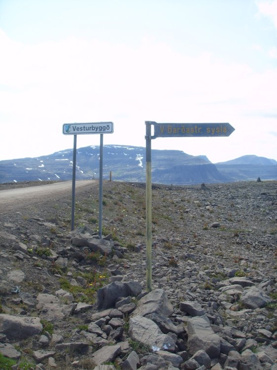
| Signs on each side of the road
marks the boundary. From about north towards about south.
|
|
 |
|
| This is also the boundary
between two counties, Vestur-Isafjarðarsýsla in south and
Vestur-Barðastrandarsýsla in south. The Icelandic county (sýsla) has
now mostly a historical significance.
|
|
 |
|
| Ísafjarðarbær is covering
Vestur-Isafjarðarsýsla and Isafjörður town.
|
|
 |
|
| From about south towards about
north.
|
|
 |
|
| Vesturbyggð is covering the
area of Vestur-Barðastrandarsýsla without Tálknafjarðarhreppur.
|
|
 |
|
| The blue circle marks the
visited point which is about 12 km west of the quadripoint
Isafjardðarbær – Súðavikurhreppur – Vesturbyggð –
Reykjaólahreppur. (Based upon an image from Wikipedia.)
|
|