| Bjargtangar (Látrabjarg)
|
|
 |
Látrabjarg is a bird cliff in the
West Fiords of Iceland. It is the largest seacliff in the country, 14 km long and 441 meters
on its highest point. Látrabjarg is in everyday speech divided into four parts,
Keflavíkurbjarg, Látrabjarg, Bæjarbjarg and Breiðavíkurbjarg.
The name origins from Icelandic látur which means "the
place where the seals stay with their pups".
The westernmost point of Látrabjarg is called Bjargtangar.
|
 |
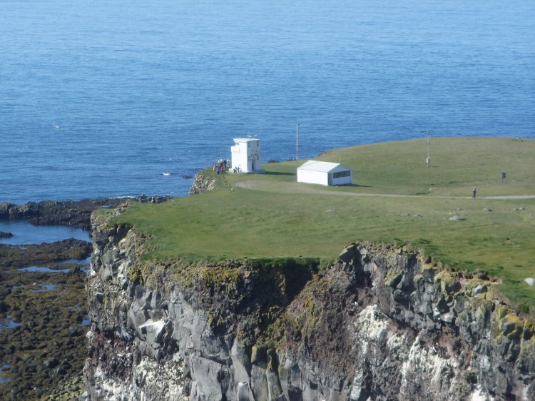
Bjargtangar
lighthouse (Icelandic: Bjargtangaviti) is traditionally regarded to be
located on the westernmost point of Iceland. In fact it is some 8-10
metres from the building to the edge of the cliff. This photo is from north towards
south.
|
|
 |
|
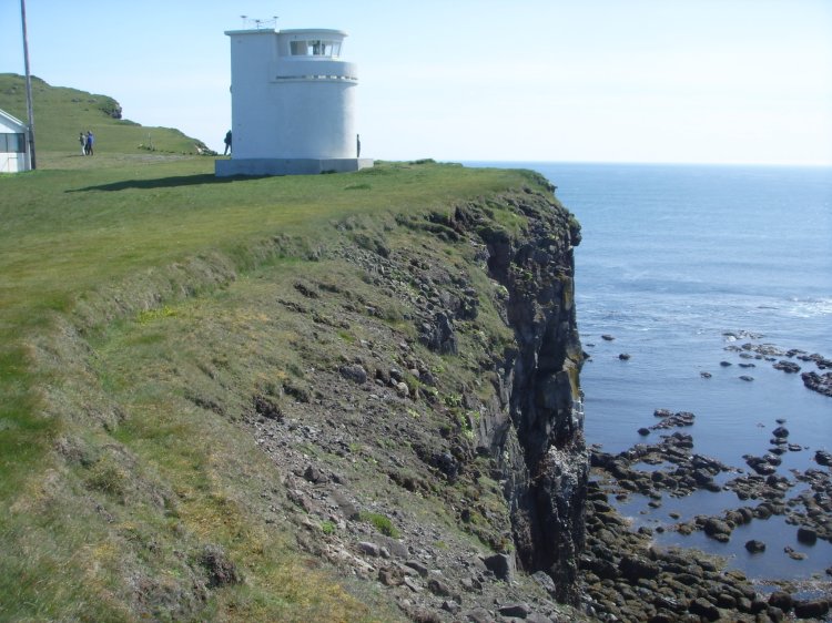
| Photographed from southeast towards
northwest.
|
|
 |
|
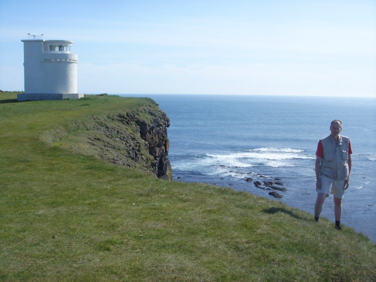
| This is the supposed westernmost
point of Europe, except "remote areas" (i.e. the
Azores, which are furthermore westward). I logged the position at the
very edge of the cliff at the lighthouse with my GPS. This position is
called "007".
|
|
 |
|
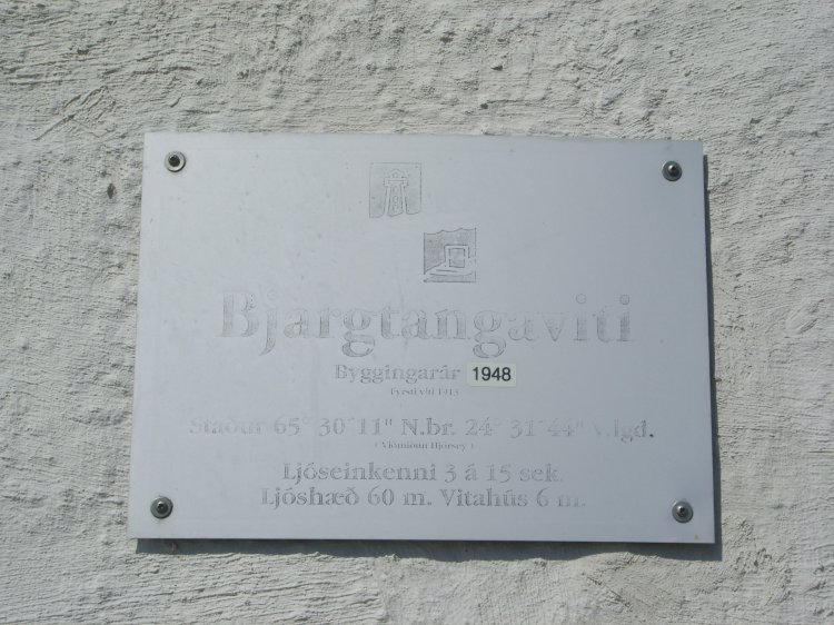
| According to the plaque the
present lighthouse Bjargtangaviti was constructed in 1948. (First
lighthouse was erected in 1913.) The position is 65° 30' 11"N 24°
31' 44" W. Its characteristics are 3 flashes in 15 seconds, light
altitude is 60 m and the lighthouse itself is 6 m tall. There is also a
radio beacon at the lighthouse.
|
|
 |
|
| The lighthouse used to house
"Sliceland, the westest pizza in Europe" – an art exhibition
on 17 May 2009. We visited Bjargartangar in July 2009 and meanwhile
"the
company" sign was broken...
|
|
 |
|
| Some 30-40 metres north of the
lighthouse there is a point which clearly is stretching itself more westward.
Photographed towards south.
|
|
 |
|
| The point is very steep and
full of loose stones. In short a very dangerous place.
|
|
 |
|
| Same point towards north.
|
|
 |
|
| I logged the position of the
point standing here. This point is called "008".
|
|
 |
|
| Same point from north.
|
|
 |
|
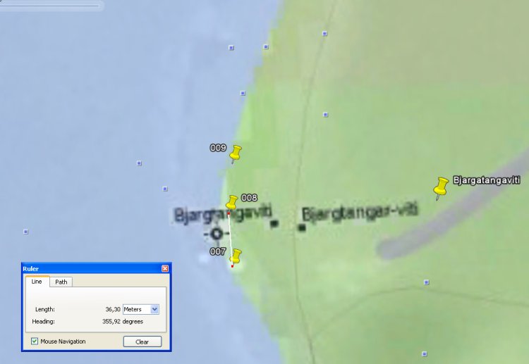
We discovered that the point
"008" is located about 2,5 m more westward than point 007 at
the lighthouse. (Additionally I found a third
point further north, called "009", which is on the same
longitude as 007). The positions registred
with my Garmin eTrex GPS device (WGS 84) are:
007: 65° 30' 09,35" N 24° 31' 54,4" W
008: 65° 30' 10,71" N 24° 31' 54,6" W
(westernmost approachable point)
009: 65° 30' 11,81" N 24° 31' 54,4" W
|
|
 |
|
| There is a difference between
the posistion on the lighthouse's plaque and my 007 position. The
explaination is that the plaque shows to another datum, which is called
ED50 and commonly used after World War II. We see here the
deviation between WGS 84 and ED50 is making about 135 metres in 70°. (Distanse
from cliff edge to lighthouse is about 9 m.) |
|
