Punduri Map
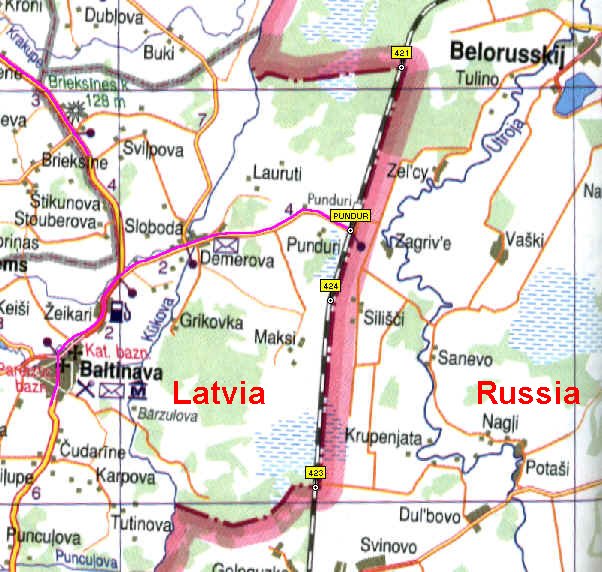
The position of the Latvian-Russian crossing
point at Punduri as it was on July 17 2003 is: 56° 58' 17,18"N 27° 45'
03,64". The location was 85 metres above sea-level. The length of the
common rail track (from waypoint 421 to 423) is about 9720 metres.
Source: Latvijas autocelu atlants, Karsu
izdevnieciba Jana seta 2002, ISBN 9984-07-267-3.