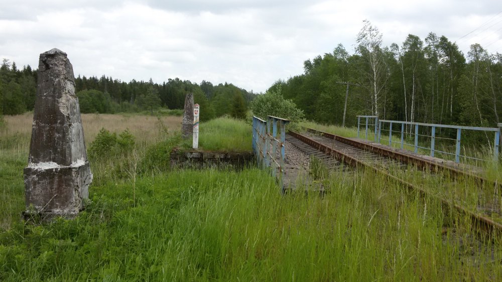
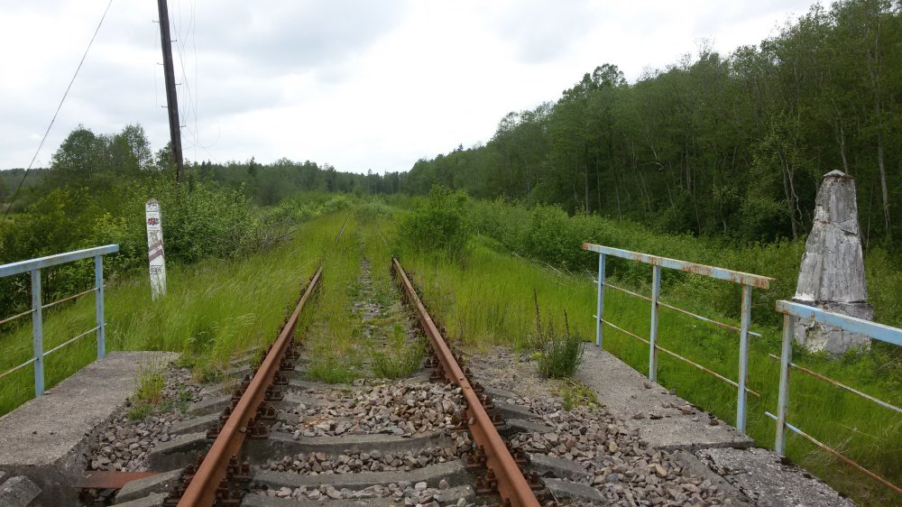
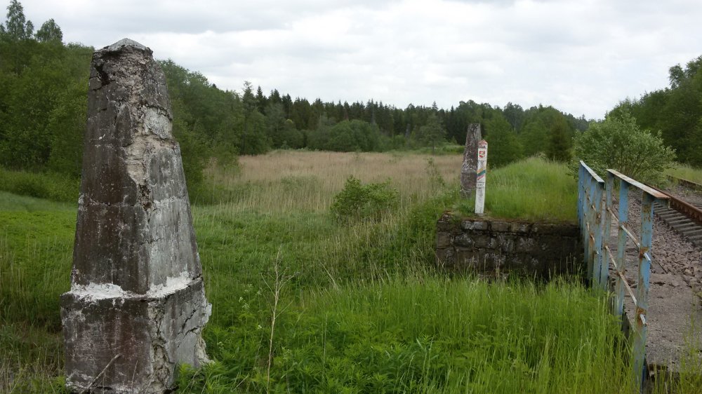
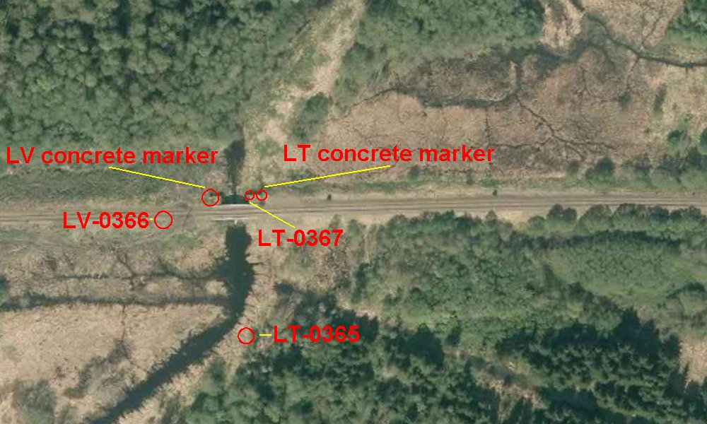
Boundary
marker 0366 (indirect) to right and marker 0367
(indirect) to left, and two old concrete border markers. Closed down railway bridge between
Mažeikiai, Lithuania
and Prikule, Latvia. Last time in regular traffic in the beginning of the
1990s. Photographed towards east. The distance between the exact border
points of 0366 and 0367 is 9,5 metres.
Position:
56° 23' 43"N 21° 58' 49"E.
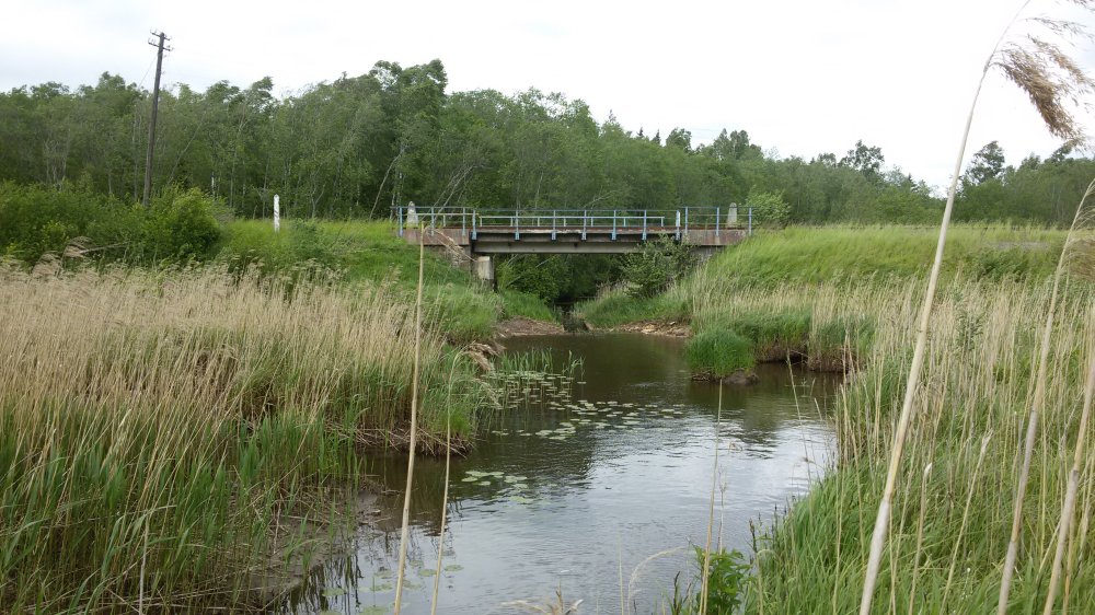
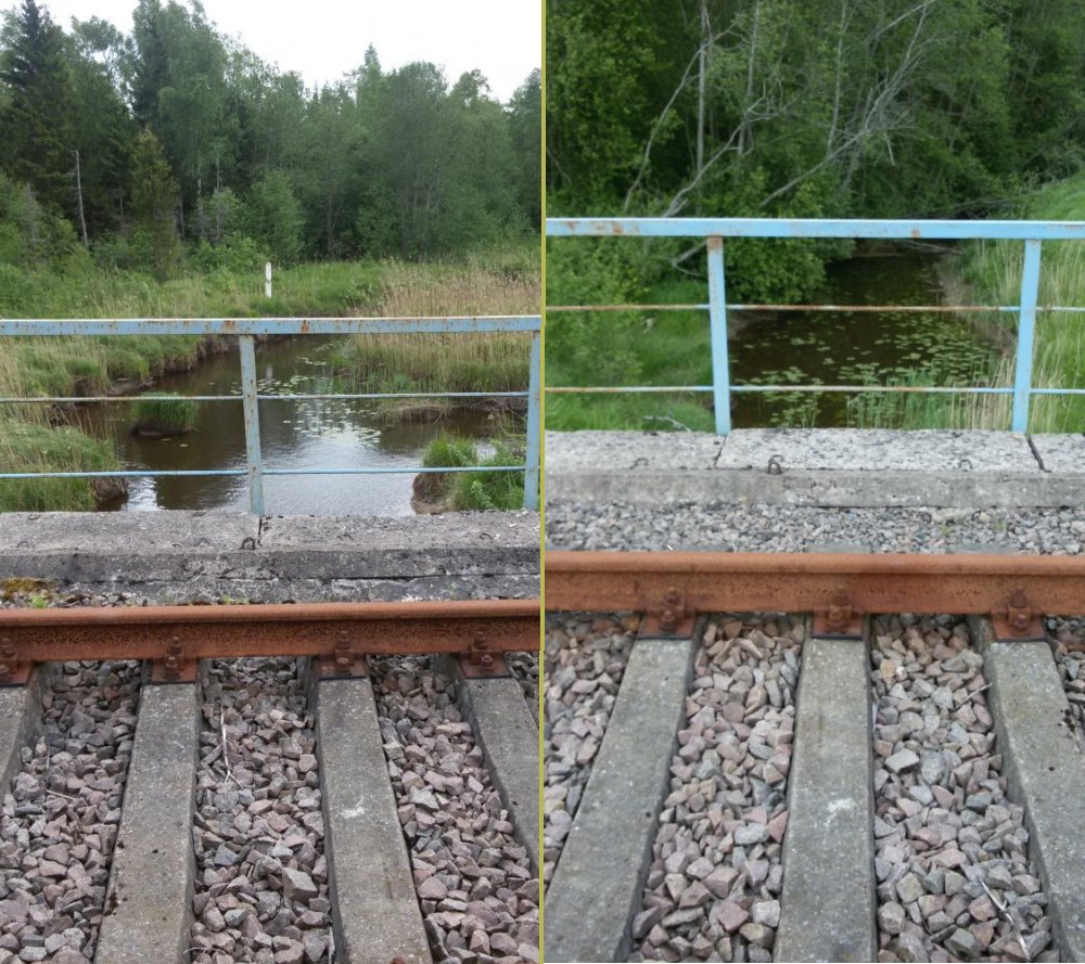
The picture is taken in the same direction as
the upper. The
bridge goes over River Lūšis(Lithuanian
form) or River Losis (Latvian form).
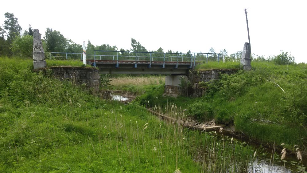
The bridge
photographed towards north. Latvia to left and
Lithuania to right.
The railway bridge
photographed towards south. Lithuania
to left and Latvia to right.
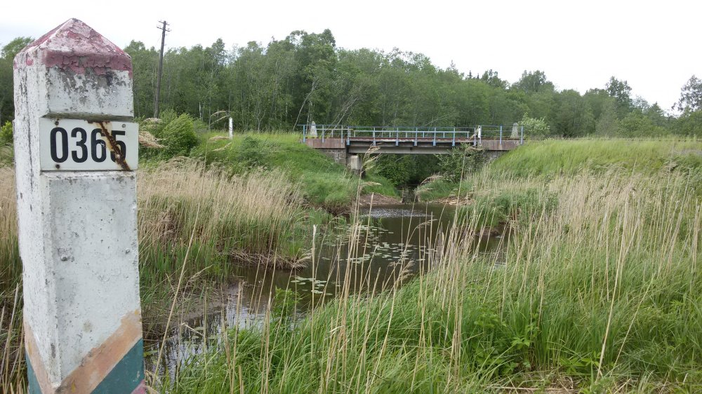
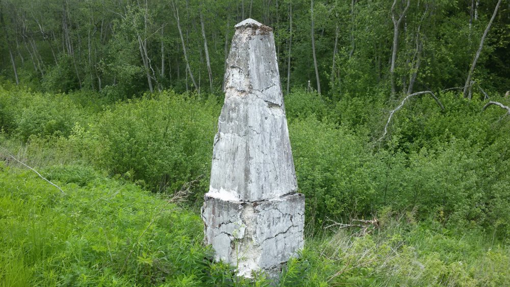
Border
marker no 0365 is an indirect Lithuanian-only marker (without
Latvian counterpart). This marker
marks a turning point on the River Lūšis. Marker
0365 is placed 5,6 metres from the exact border point and it is 40,1 m.
until the border point of marker 0366.
Marker 0365
photographed towards south.
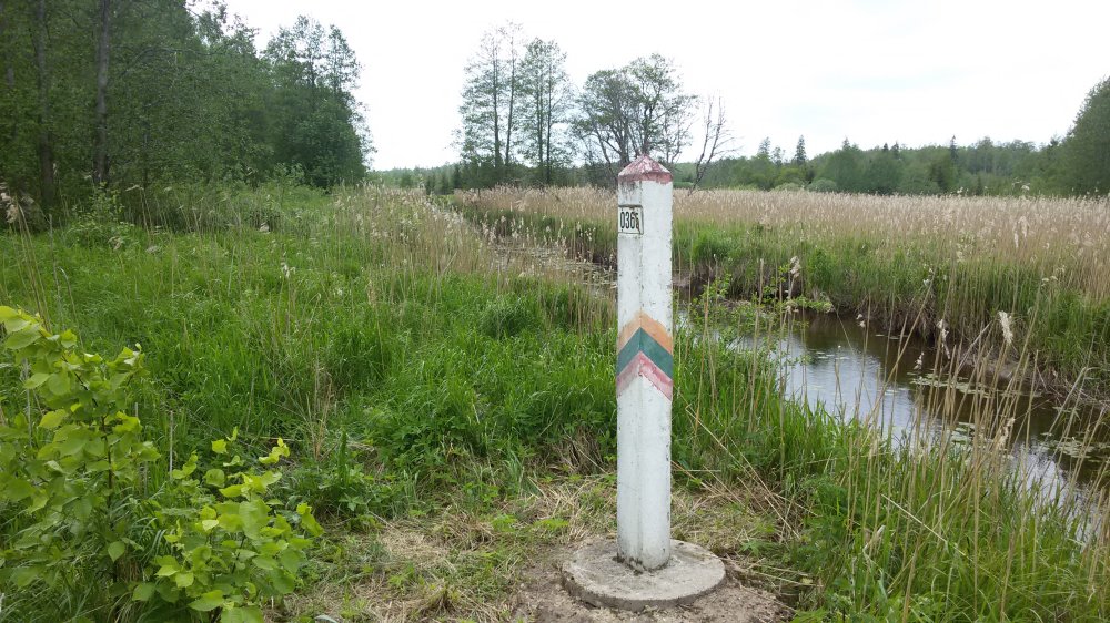
Close-up of marker 0365.
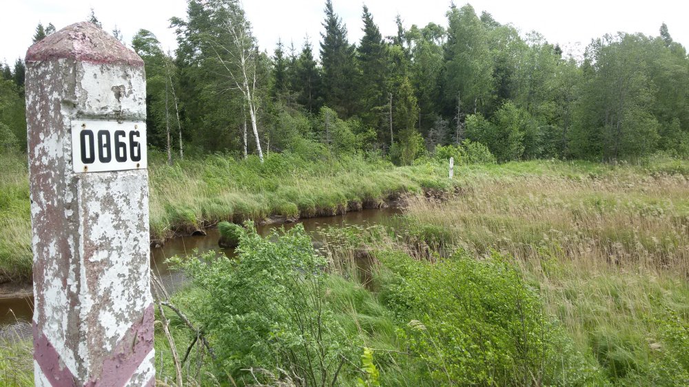
Marker 0366
(from this side only mistakenly marked as "0066") is an indirect an
Latvia-only marker, photographed in direction of marker 0365. Marker
0366 is placed 14,2 metres from the exact border point in the middle of the
river
Marker 0366 photographed in direction of west and
Latvia.
Marker 0366 photographed towards northeast.
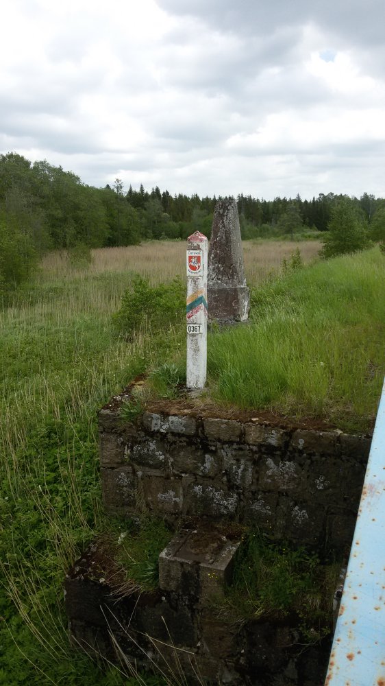
Marker
0367 and the Lithuanian concrete marker photographed towards east. Marker 0367 is placed
5,6 metres from its exact border point. It is 215,1 metres between the
border points of 0367 and 0368.
Marker
0367 and the two concrete markers.
Marker
0367 photographed from the bridge.
Marker
0367 photographed from east towards west. Note
that the Lithuanian marker has a vertical top.
While the top of the Latvian concrete marker is
pyramid-shaped.
The coat of arms on both
concrete markers were put on the sides facing the railroad tracks. One can
still see where the Latvian coat-of-arms was.
River Lušis towards west
(left) and east (right) photographed from the middle-point on the bridge.
Maps
Border
map of 2012 (LGIA, Latvia). The border runs in the middle of the
river.
Fragment of border
map no. 18 of 1927 where the two concrete
markers were is drawn on the map. The old
marker no. 81 was situated about 55 metres north-northeast of present marker no.
0367. The borderline of 1927 is
marked with blue lines, while the red lines mark the present border where it
differs. At the most, the present border line
deviates with the old line up
to about 75 meters. The reason is that the old border followed the
natural course of the river, while the current boundary follows a regulated
and more straightgoing river flow..
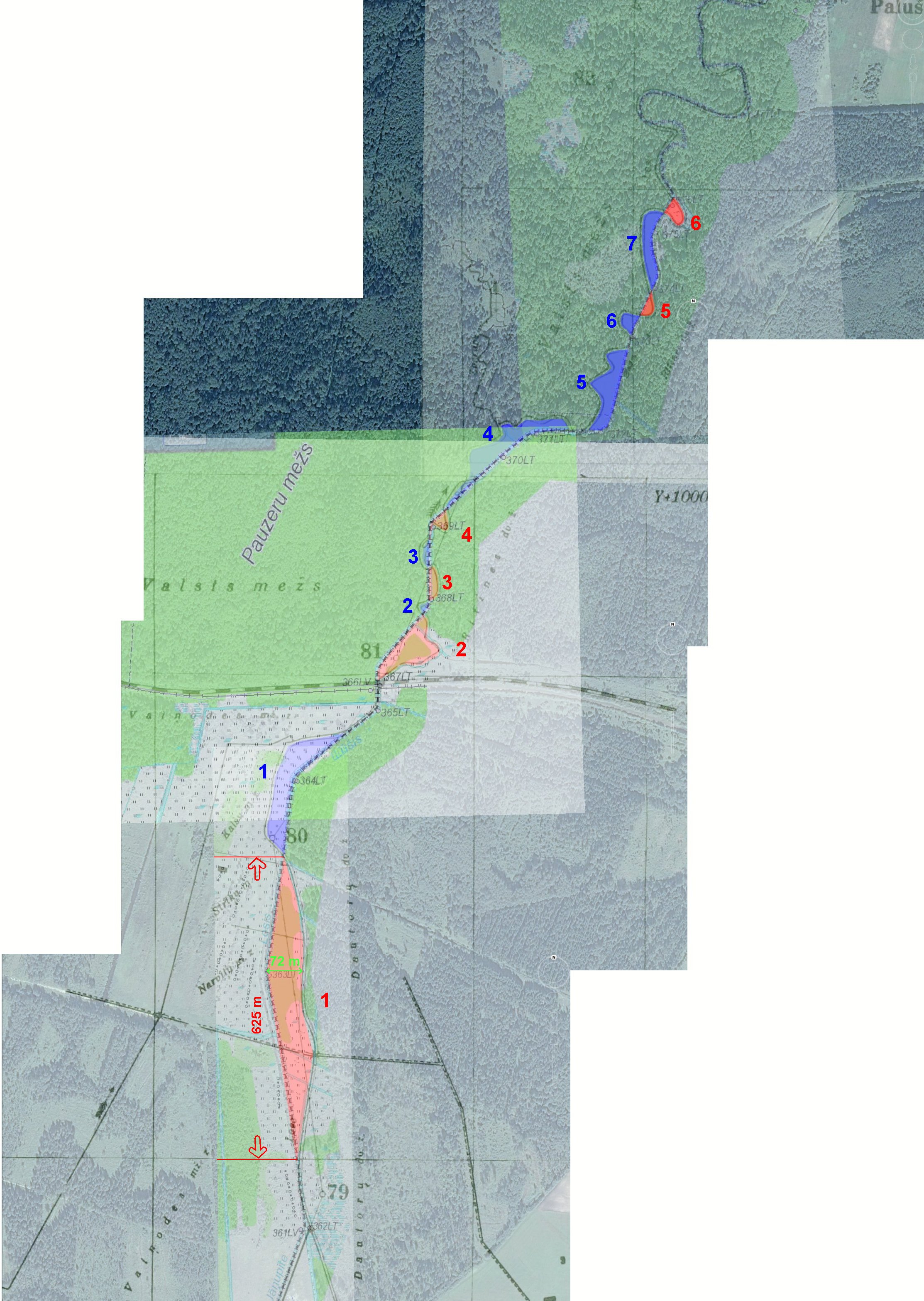
Ortomap of the 13 swapped small areas located betweeen markers LT-0362 and
LT-0376. In 2000 at the re-demarcation of the Latvian-Lithuanian border,
Latvia gave Lithuania 4,15 hectares (marked in red), while Lithuania
returned to Latvia 3,17 ha (marked in blue). The biggest swapped is the most
southern. Its size is 3 hectares. Clickable!
Ortomap of the railway bridge and its border markers. Image: maps.lt
The
point was visited in May 2015.
Sources
and links
Treaty of 1927, page 221.
This page was first time made on 15 June 2015. This page was
last time updated
21/06/15
.