Jan
S. Krogh's Geosite: German-Luxembourg
(DE-LU) Boundary at Vianden
The only part
of the German-Luxembourg boundary which is not a part of the condominium
is the Luxembourg area east of River Our at the village of Vianden.
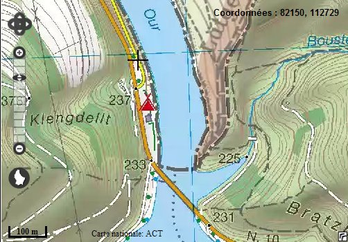
The
northern part of the condominium is ending north of Bildchen. The border
is continuing east and south of the Luxembourg village of Vianden. (Map:
geoportal.lu)
The
dry German-Luxembourg land boundary
is about 6,2 km long. At the end of WWII Luxembourg planned to demand
Kammerwald forrest east of Vianden as German war compensation, but such a
demand was never presented.
(Image:
google.com)
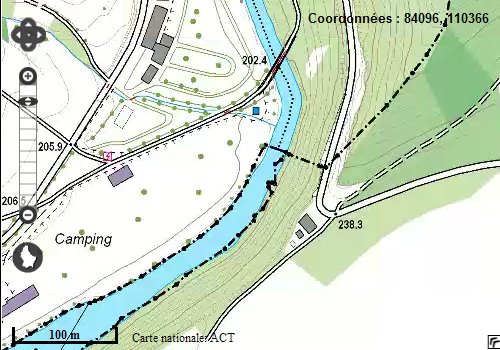
The
southern part of the condominium is starting north of the village of Roth
an der Our. (Map: geoportal.lu)