|
The Common German-Luxembourg Territory (DELU)
The
Condominium is consisting from at least 9 possible dry condominium islet areas (numbered
1 – 9) which also are found on official maps. There are also four more islets partly with adjacent river
territory (A – D) which according to the
Luxembourg mapping and other information appear to be exclaves inside the
condominium.
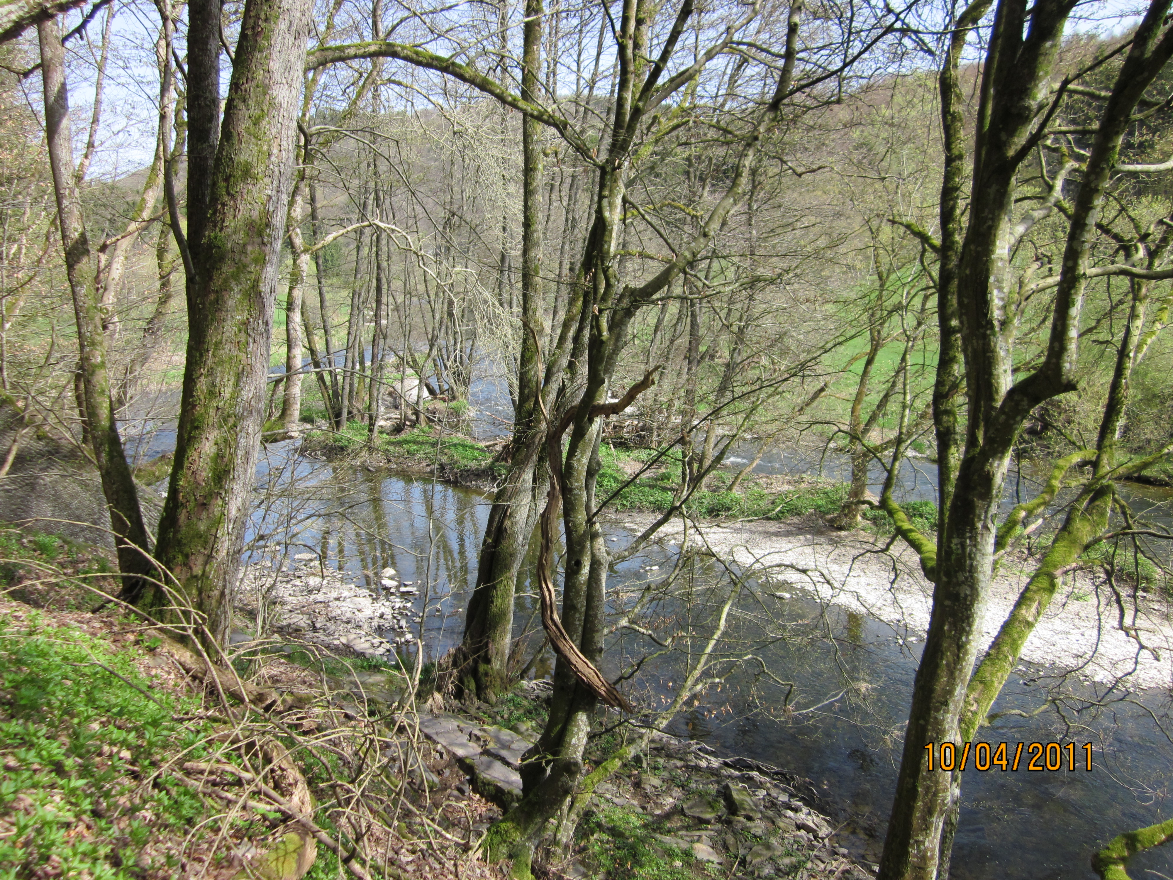
Most of them are islets, the biggest of them, island 7 is about 220 x 74 metres
big and therefore larger than Pheasant
Island.
Islands no. 1, 2 and 3 are in River Our, islands A, B, C and D and no. 4,
5, 6, 7 and 8 are in
River Sauer and island no. 9 is in River Mosel. Only islands also found
on topographic maps are listed.
|
|
|
Island 1
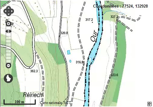
Island
no 1 is only about 5 m long. Position 50° 7' 38" N 6° 8' 15"
E.
(Image: Le Géoportail National) |
The
islet is located about 278 m south of BEDELU.
|
|
| Island 2

Island
no 2 is about 80 m long and C-shaped. Position 50° 6' 29" N 6° 7'
51" E.
4.6878 ha land east of the Our belong to Luxembourg.
(Image: Le Géoportail National) |
|

The
islet is located about 2,2 km south of islet 1.
|
|
|

Photo
of island no 2. (Photo: © Juliet-Zulu)
|
|
| Island 3

Island
no 3 is about 30 m long. Position 50° 4' 28" N 6° 6' 58" E.
(Image: Le Géoportail National) |
|

The
islet is located about 3,9 km south of islet no 2.
|
|
| Islands A and B

Island
A (173 x 30 m) and B (80 x 10 m) seem not to be a part of the DELU
condominium and appear therefore to be German exclaves.
Position of A is 49° 50' 45"
N 6° 20' 21" E.
3.9632 ha land west of the Sauer belong to Germany.
(Image: Le Géoportail National)
|
|
|

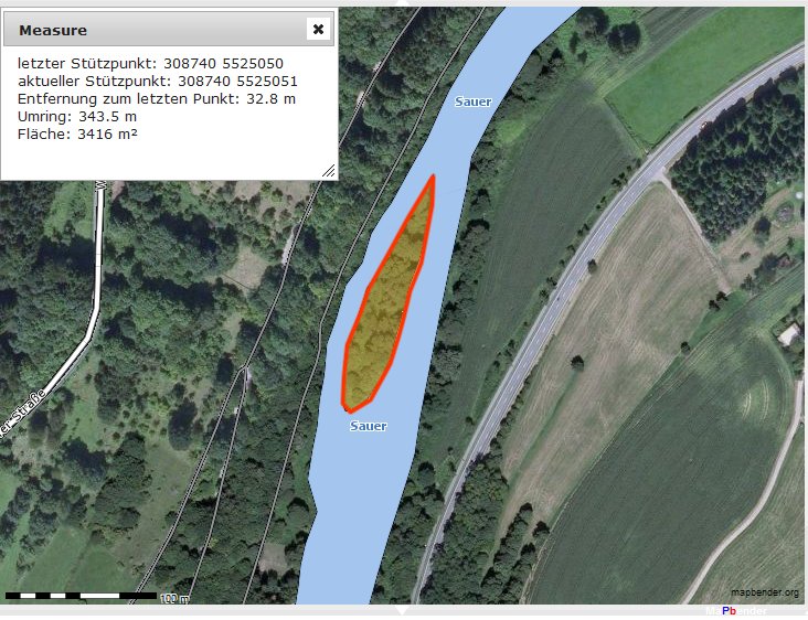
Islets
A and B are located about 30 km southeast of islet no 3. |
|

As
all the other islets, neither these are populated. (Image: GeoBasisViewer) |
|

Only
islet A was registered on German mapping. Its area is about 0,34 ha (3416
m²).
(Image: GeoBasisViewer) |
|
| Islands C, D and E

Island
no D is only about 124 m long and 28 m wide. As A and B neither these are
according to this Luxembourg map a part of the condominium, and appear
therefore to be German exclaves.
Position of island D is 49° 50' 21" N 6° 22' 41" E. (Image: Le Géoportail National)
|
|
 They
are located about 2 km southeast of the German village of Bollendorf. |
|
 The
islets are clearly visible on German ortomap. (Image: GeoBasisViewer) |
|
 Anyway
they are not registered on this German topographic map. (Image: GeoBasisViewer) |
|
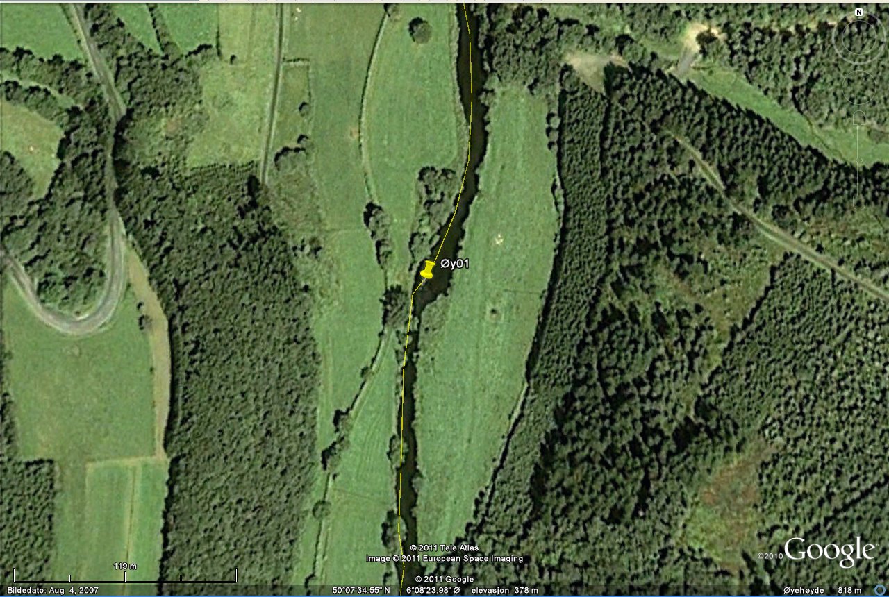
| Island 4

Island
no 4 is about 130 m long and 30 m wide. Position 49° 44' 40" N 6°
30' 9" E.
(Image: Le Géoportail National) |
|
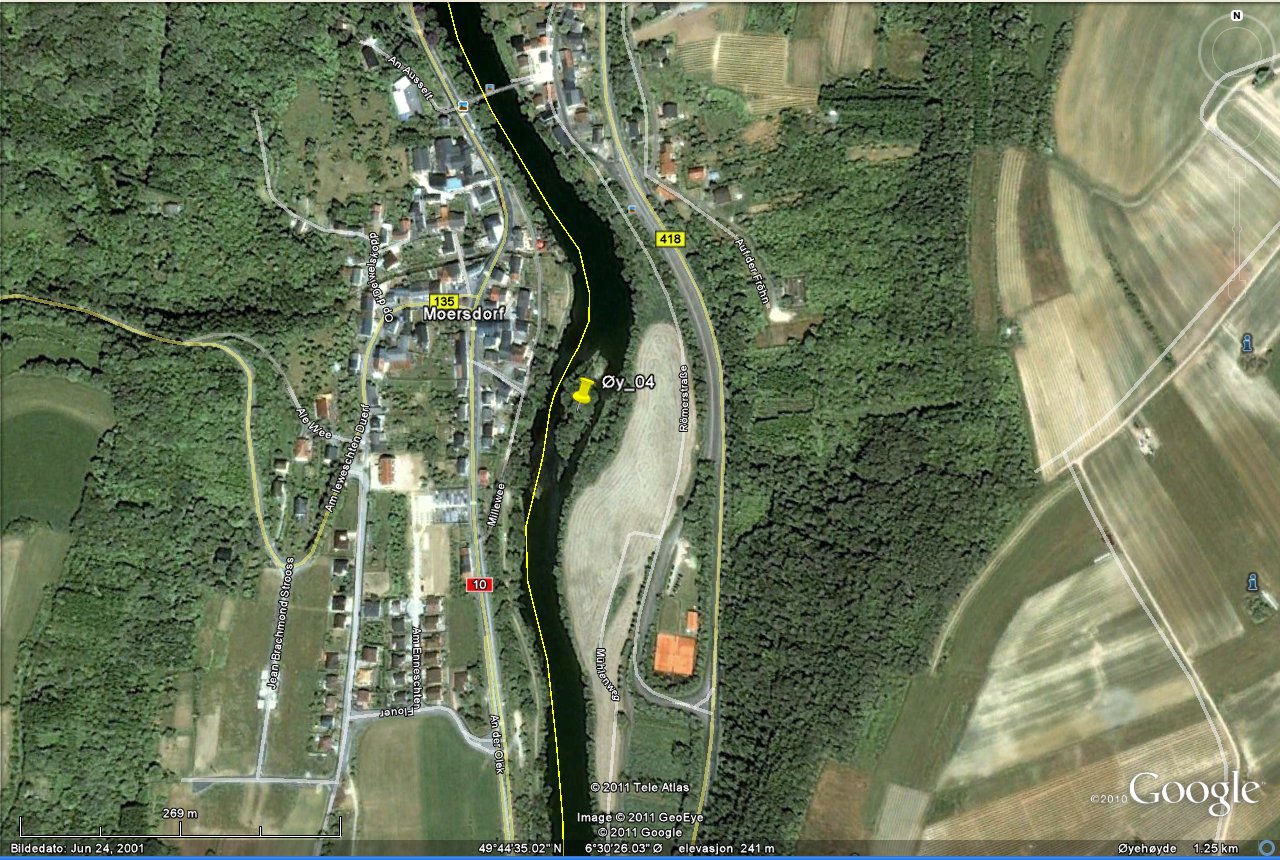 The
islet is located about 13,8 km southeast of islet D. |
|
| Islands 5 and 6
Island
no 5 is about 266 m long. According to the Luxembourg map only the
southern islet parts are condominium. They both border Germany on the
middle, most likely because the river has changed her position since the
border was agreed between the two countries. Position of islet 5 is
49° 43' 42" N 6° 30' 24" E.
(Image: Le Géoportail National) |
|

Islet
no 5 is located 1,7 km south of islet no 4. |
|
| Island 7

Island
no 7 is about 221 m long and 74 m wide. Position 49° 43' 15" N 6°
30' 44" E.
(Image: Le Géoportail National) |
|
 The
location is 1 km south-southeast of islet no 5. |
|
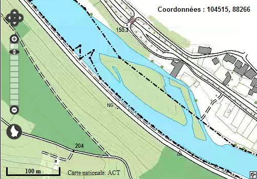
| Island 8

Island
no 8 is about 190 m long and 50 m wide. Position 49° 43' 22" N
6° 29' 48" E. Here we see the condominium also has a very
small part of the left river bank.
(Image: Le Géoportail National) |
|
 Islet
no 5, 7 and 8 are shown also on the German map. Islet no 8 is situated
just west of the German village of Langsur. (Image: GeoBasisViewer) |
|
 The
location is about 1,1 km west of islet no 7. |
|
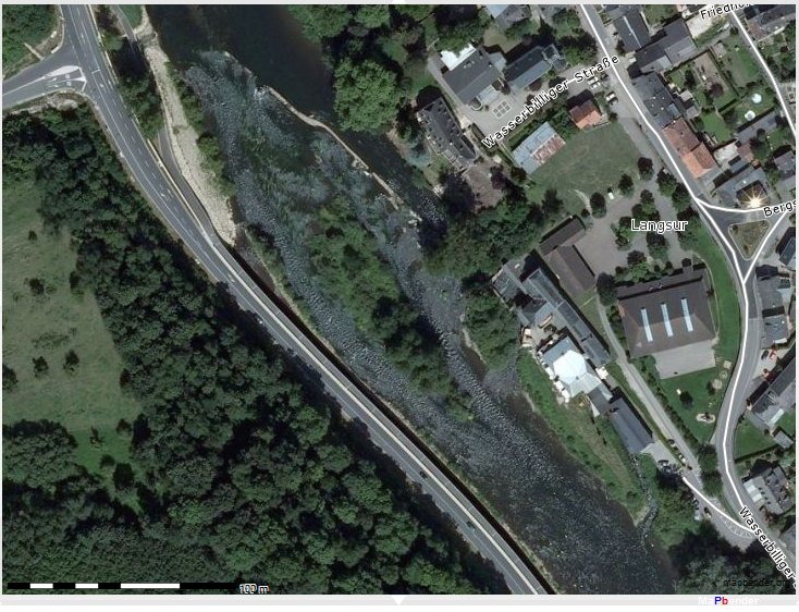 This
German close-up satelite image seems to have been taken when the river
level was very low. (Image: GeoBasisViewer) |
|
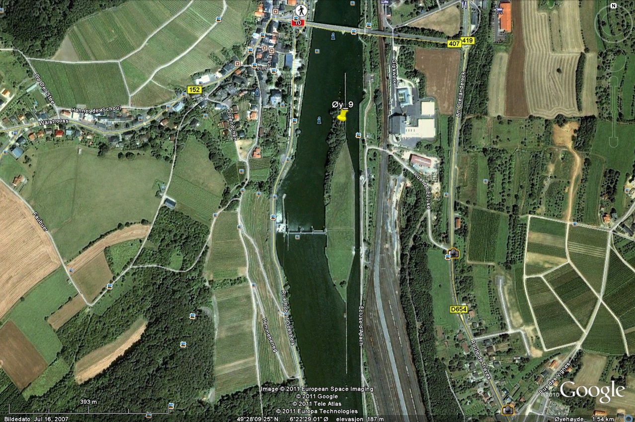
| Island 9

Island
no 9 is very close to DEFRLU tripoint. The condominium part of the island
is only about 65 m long and 28 m wide. Position 49° 28' 10" N 6°
22' 5" E. It is located about 30 km south of islet no 8. |
|