The
northern tripoint area is consisting from two technical tripoints and one
triline area. The western technical tripoint – BEDELULU – at the
western riverbank is between Belgium and Luxembourg and the condominium.
The eastern technical tripoint – BEDEDELU – is in the midle of the
river between and between Belgium and Germany in north and the condominium
in sourth. The line between these two technical tripoints forms the actual
triline boundary – BEDELU – between Belgium in north and the common
area of Germany and Luxembourg in south. This line is about 5 meter long
and stops in both ends one single point before both tripoints. (Image: Le Géoportail National)
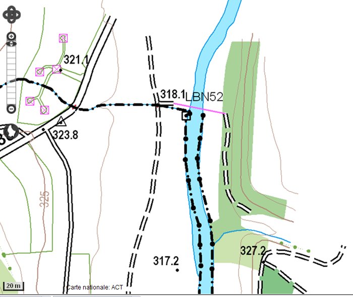
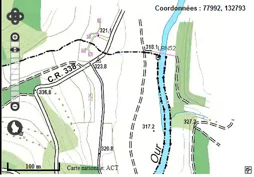
The
Luxembourg marker LBN52 is not located exactly at the western technical
tripoint (which is where the creek meets the River Our), but slightly
south of it. (Image: Le Géoportail National)
The condominium
boundary is not always strictly following the river banks as the river
changes shapes from one year to another. (Image: Le Géoportail National)