The
Kopaczów Bridge with border marker IV/146 on the northern river bank
side.
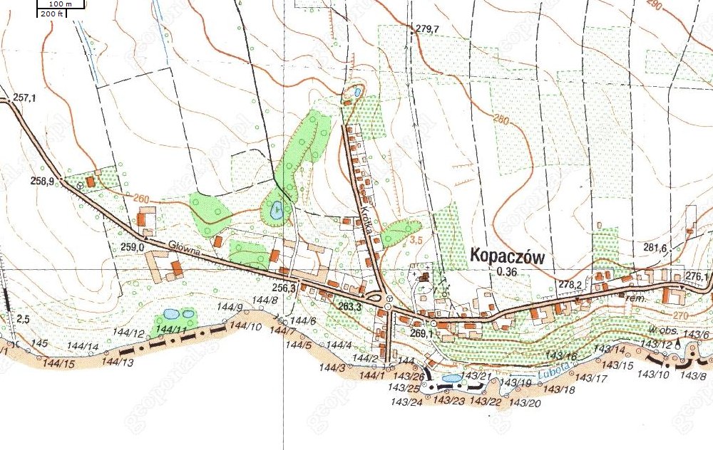
Kopaczów
(German Oberullersdorf, Czech Kopačov) - a village in south-western Poland, Lower Silesia, in the county Zgorzelec, in the municipality Bogatynia, about 5 miles west of Żytawy. Creates a de facto one body
with the Czech village of Oldrzychów na Granicach, which is formally part of
Gródka nad Nysą. The boundary between them is partly determined by the Lubota
Brook and partly it runs along the main street of the village, by the locals
called the "neutralką".
The division of historical
Ullersdorf reaches the sixteenth century, when the northern part (today's Kopaczów) belonged to the state
of Frýdlant, while the southern belonged to Grafensteiń. In 1635 the Upper Lusatia, which includes the northern part
(the southern part was in the Czech Republic), was by the Austrian Emperor Ferdinand II as an expression of gratitude for the conclusion of peace given to Saxony. Despite this village over the next centuries, functioned as a unit, the actual breakdown occurred only with the regulation of the Austrian-Prussian War (in 1815, part of Saxony became part of Prussia) in 1849. This division is maintained despite changes in governments from 1945
(when Kopaczów joined Poland).
The population of the two parts
are formed by post-war migrants, as the indigenous German population was displaced after World War II. Furthermore, the name Kopaczów - as opposed to Oldrzychowa - was artificially given the same period and has nothing to do with historical sound
of Ullersdorf / Vlrici villa.

Close
up of border marker IV/146.

The
expedition is kindly asked to leave the area by Czech ralley organizers.
On the southern river bank we observed middle marker IV/144/1. From
left: Peter, Hans Peter, Steen, Udo and Jesper.