Jan S.
Krogh's Geosite: Kul'kishki (BY) – Sakaline (LT)
divided village – maps
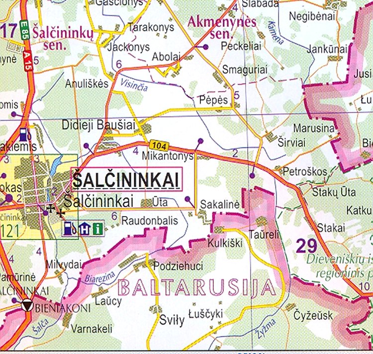
The villages of Sakalinė
and Kul'kishki are very close, but in order to visit people on the other
side of the fence one has to travel via Šalcininkai and Bieniakoni. (Map:
Lietuvos autokelių atlasas, 1:200.000, Jana seta, Riga, 2008. ISBN
978-9984-07-475-7.)
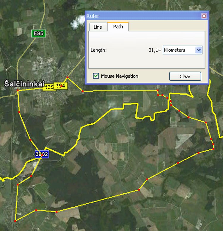
The quickest legal route
between the two villages, partly on unpaved roads, is 31 km. It takes
about 1 hour each way – the border crossing alone takes minimum 20
minutes, while driving alone about 30 minutes. But sometimes it is
impossible to get from the main road to Kul'kishki because of muddy
road. Most villagers anyway do not have any car, or money for petrol
and visa. But, there is a locked door in the border fence in this
which technically can be opened...
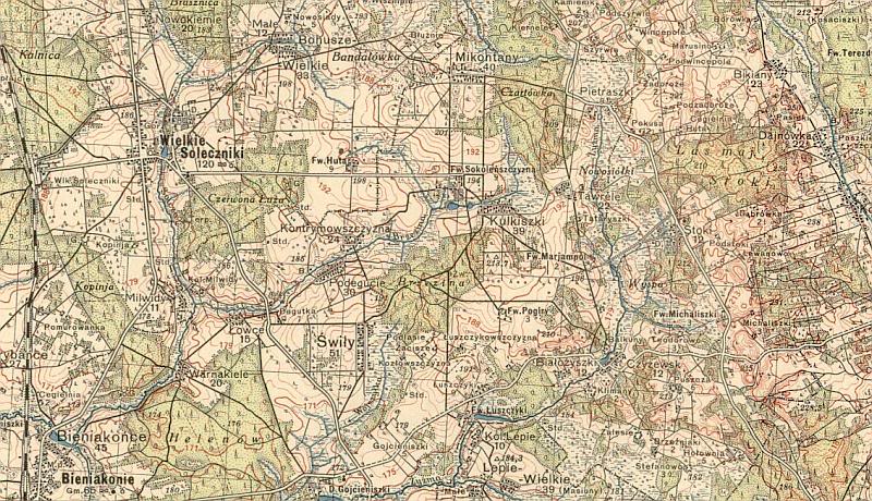
This Soviet map shows how
incorporated the Byelorussian village was in Sakaline. The main road
access was through Sakaline and Lithuania. (Source: Soviet map sheet
N-35-63-71V).
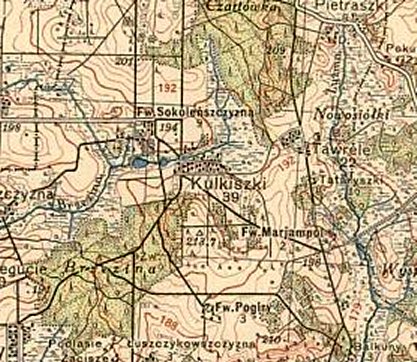
In 1935, after Poland had occupied
Vilnius area from Lithuania, we find Sakaline and Kul'kishki – but now
both villages have Polish names. (Source: WIGP 31S41 Soleczniki,
1935.)
On this map we can see
Sokolenszczyana and Kulkiszki were two separated villages.