| "American-European Boundary"
(Mid-Atlantic Ridge)
|
|
Grjótagjá near Krafla vulcano

|
Iceland
is situated on the Reykjanes Ridge, a part of the Mid-Atlantic Ridge,
between two tectonic plates which very slowly are drifting apart. Here I
have one foot (my right) on Eurasia's tectonic plate and the other on
the North American tectonic plate. (Eurasia is left, North America is
right.) Note the level difference as America is slightly higher
than Eurasia.
|
| Þingvellir

|
|
| Here I am standing in
Thingvellir, between the tectonic plates, North America on my right.
|
|
 |
|
| Thingvellir again, the cliffs
mark the meeting point of the plates.
|
|
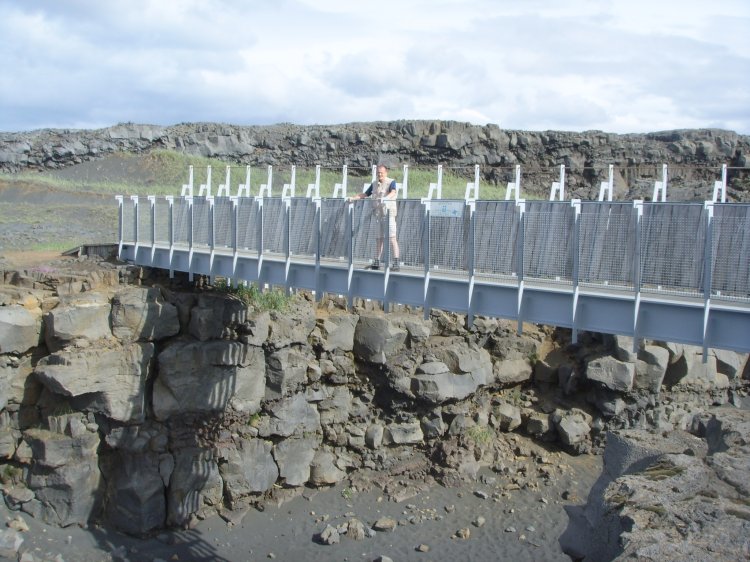
| Reykjanes

|
|
| At Reykjanes, southwest of the
capital, there is a touristic bridge between Europe and America.
|
|
 |
|
| Here one may walk about 15
metres over from one continent to another. North America to left, Europe
to right.
|
|
 |
|
| On this photo I am exactly on
the middle, looking towards south.
|
|
 |
|
| This was my view, Europe to
left and North America to right.
|
|
 |
|
| "Miðlína" is
Icelandic for "middlepoint" where one is welcomed to North
America and to Europe, probably depending on wherefrom you arrive.
|
|
 |
|
| On the Mid-Atlantic Ridge
where Iceland is located, the tectonic plates move in opposite direction
of each other. On one hand, Iceland is becoming slightly bigger
and on the other hand the distance between North America and Europe
increases with about 22,3 mm per year (i.e.
the spreading motion of the mid-Atlantic
ridge in the north). (Image: Wikipedia.)
|
|