 | |
|
San'kovo Medvež'e Maps
 |
|
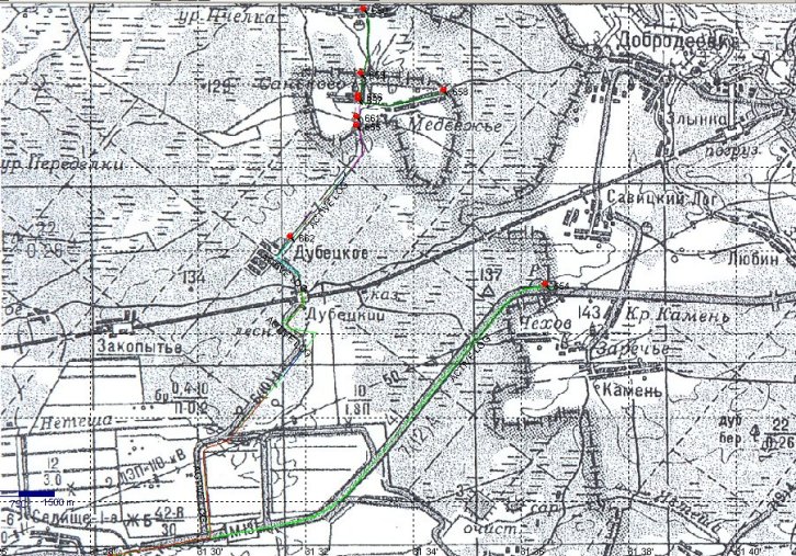
The GPS tracks and waypoints of our visit is laid out on this map.
|
 |
|
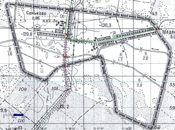
An enlargement of the enclave area itself. We did not visit Sankovo because the street was overgrown of vegetation. Positions of waypoints: 654: 52°26'33,5"N 31°36'29,8"E (141,2 m), 655: 52°28'27,6"N 31°32'59,3"E (138,31m), 656: 52°28'49,3"N 31°33'01,4"E (132,5 m), 657: 52°28'46,7"N
31°33'01,2"E (132,3 m), 658: 52°28'53,1"N 31°34'36,8"E (131,6 m), 659: 52°29'05,5"N 31°33'03,9"E (127,0 m), 660: 52°29'51,7"N 31°33'06,9"E (123,4 m) and 661: 52°28'34,0"N 31°32'59,3"E (125,6 m). Air distances (in km): 655–661: 0.197, 661–657: 0.396, 657–656: 0.08, 656–659: 0.50, 659–660: 1.43 and
657–658: 1.815.
|
 |
|
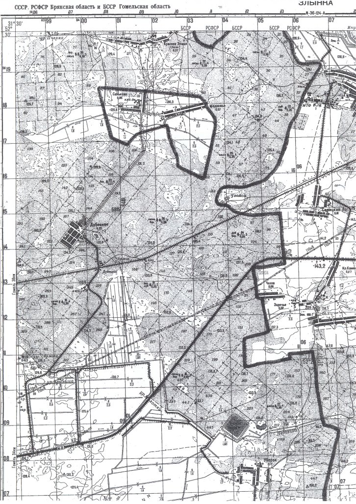
Following air distances were measured (in km): 1–2: 2.85, 2–3: 0.80, 3–4: 1.67, 4–5: 0.80, 5–6: 1.23, 6–7: 0.87, 7–8: 0,41, 8–9: 0.49, 9–1: 1.47, 1–4: 3.92 and 4–2: 2.32.
|
 |
| San'kovo Medvež'e is consisting from two
villages, San'kovo (west) and Medvež'e (east). Due to the explosion in
the nuclear power plant in Černobyl in 1986 this area is polluted
and left. At the most narrow point the distance from the exclave (at its south eastern corner) to mainland Russia is only about 570 metres.
I would like to thank especially Dr Brendan Whyte for his contribution of maps and other information to this report.
|
|
|
This page was last time updated 31/01/12 . |


