Jan
S. Krogh's Geosite: Lithuanian-Russian 2003 Border Treaty and Land Swap
The
entire Vištytis Lake makes according to our calculations about 1749,3 ha.
Before 2003 Lithuania's share was only about 40 ha (2,2 %), but from the
new border treaty was effective, the Lithuanian part increased to about
383 ha (about 22 %). In short Lithuania
gave up 30 hectares dry land in order to get about 343 hectares bigger
lake territory from Russia. The size of Lithuania increased therefore
with about 31,3 km². Anyway the larger population around the lake
is on Lithuanian side. The Lithuanian - Russian boundary north of
Vištytis town shall according to our information be the same as the
administration line previous to the 2003 treaty.
Areas in hectares
Before Border Treaty
After Border Treaty
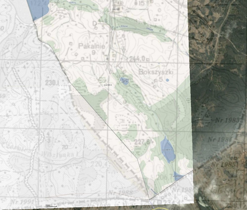
Western part of Darius ir Gireno gatve
(dry land)
0
2
Lithuanian lake territory
40
383
West of Pakalnie (dry land)
0,8
0
Southern Vištytis (dry land)
31
0
Total
71,8
385
We
calculated the entire Lake Vistytis area by Ozi Explorer and got result
that it makes about 1749,3 ha. Line "A" is the
Lithuanian-Russian lake boundary before the 2003 border treaty; line
"B" is the new Lithuanian-Russian lake boundary after the
treaty while line "C" was Lithuania's position during the
negotiations with the Russian side.
Before
the border treaty the Lithuanian part of the lake was only a very narrow
part south of the city centre, making about 38 ha., calculated with
maps.lt calculator.
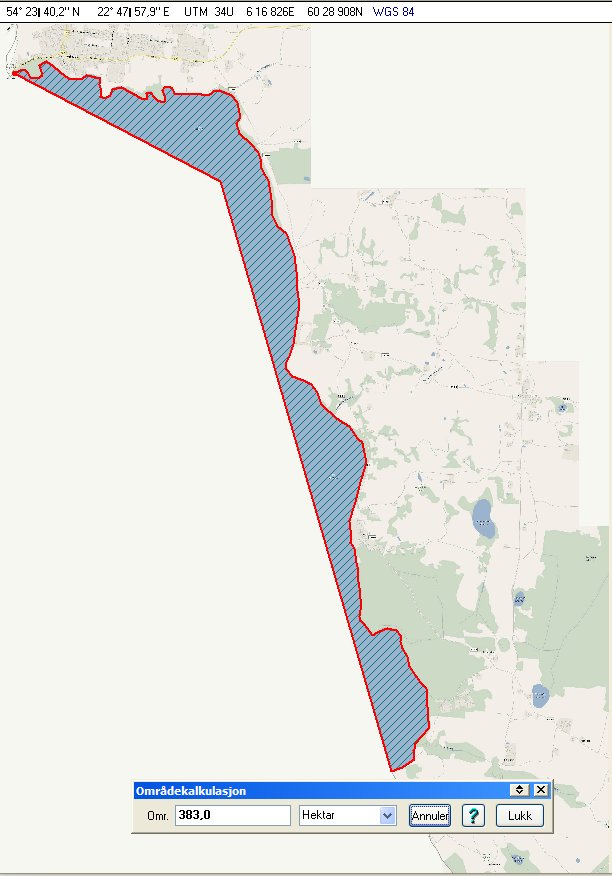
By
calculating the area of the maps.lt map with Ozi Explorer we got an old
Lithuanian lake territory of 45 ha. Note that the coastline is
slightly different compared with the upper map.
According
to the maps.lt calculator the total Lithuanian part makes only 376,76 ha.
Calculating
the area of the maps.lt map with Ozi Explorer we got an present Lithuanian
lake territory of 383 ha. The total lake boundary lenght is about
8944 metres. North and east of the boundary there is a 50 metres wide
Lithuanian Border Protection Zone, which totally makes about 45 ha and
where the public is not allowed. The most narrow points of the
southeastern part of the Lithuanian part of the lake are only 105-110
metres wide. Boats should therefore keep close to land while passing these
headlands. The Border Protection Zone is marked with red buoys, while the
boundary is marked with yellow buoys.
Here
is the old Soviet map between the Russian Federation and the occupied
Lithuania (in grey) with an overlay of the new boundary between
Lithuania and Russia (coloured). We can see that the territory of
Lithuania has moved east and therefore is smaller.
The
northernmost tiny territory south of the lake is less than 1 ha.
The
southernmost area is about 31 ha along about 2/3 of the southern part of
the border south of the lake. The biggest width is about 188 metres.