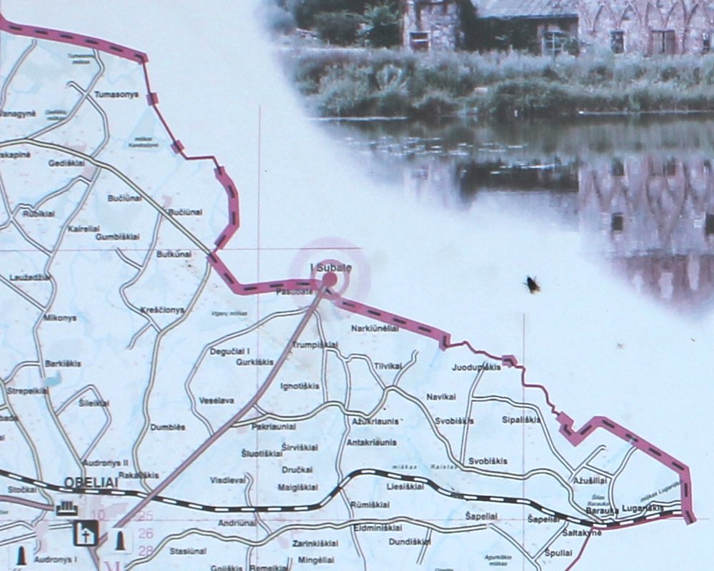
The
boundary watched from Lithuania towards north and Latvia where the town of
Subate (pop. 1222 [2004]) streches to the state border. On the
southern side the Lithuanian town of Obeliai (pop. 1241 [2010] is located
8 km further southwest. At the borderline the Lithuanian Road 122
meets with the Latvian Road P70. To left border marker no. 1357 and
to right no. 1358.
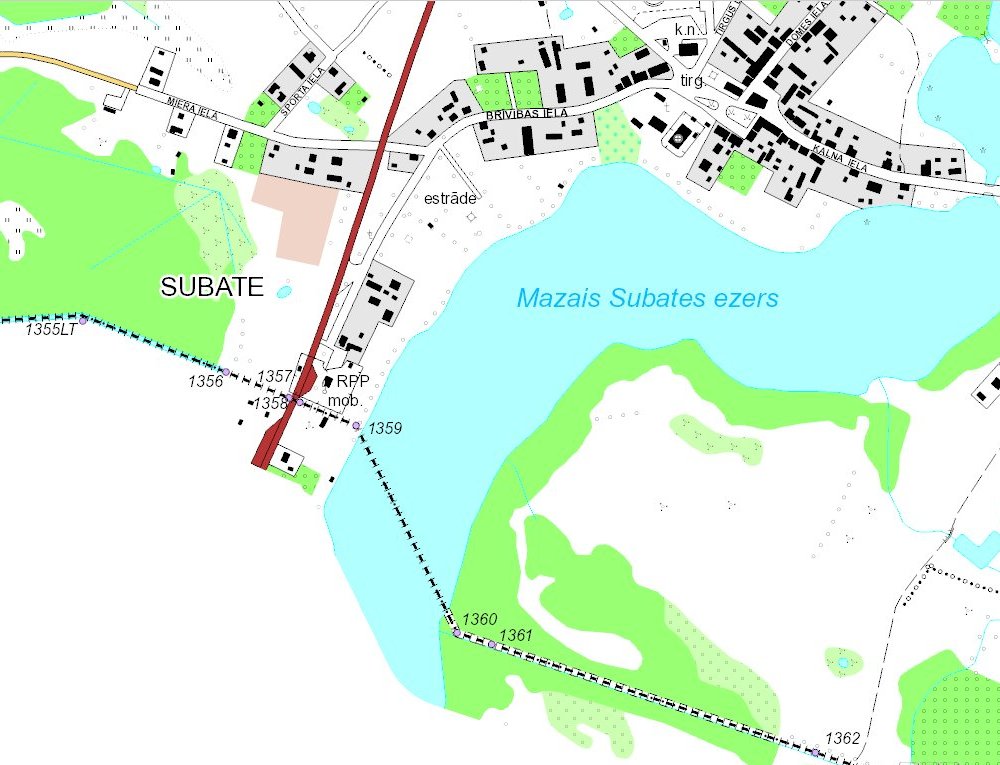
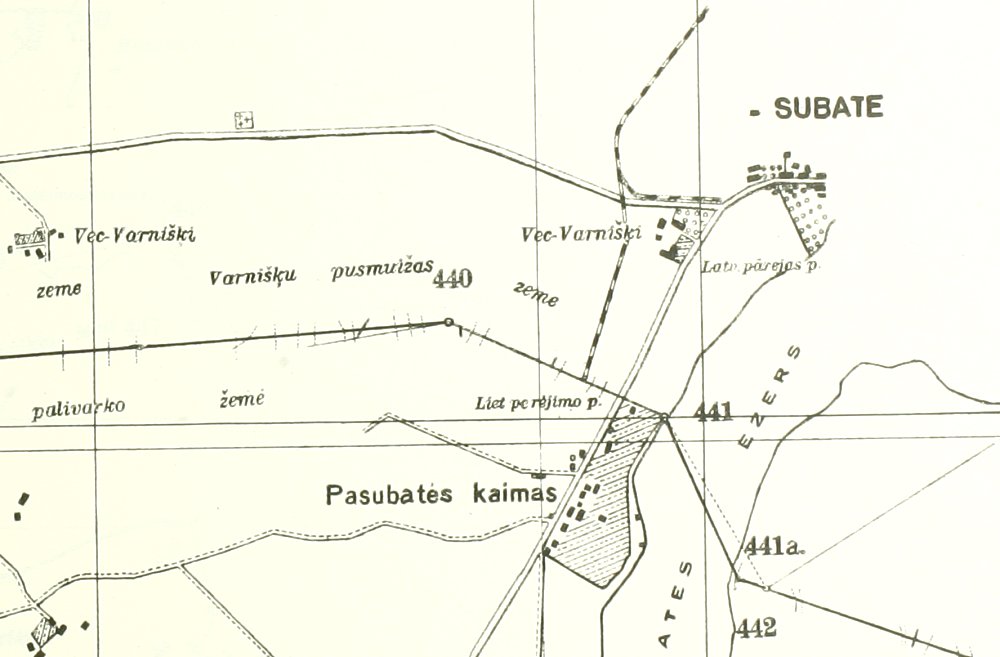
From
north towards south and Lithuania's village of Pasubatė. The
boundary slightly changes direction between at these border points.

Members of an excursion in 1935 from Rokiškis Gymnasium to
Daugavpils at the border. Behind we can see the Lithuanian concrete
marker 1. The first from the left
is Mr Pranas Simanavičius (1905-1962), a painter and teacher (since 1931
the drawing teacher of the gymnasium), and Museum Curator (Head of
Rokiškis Regional Museum 1941-1944). Photo from the album of Mr.
Simanavičius.
© Rokiškis Regional Museum.

The
above photo was probably taken here, although the 1935 road was slightly
closer towards the lake (see maps below).
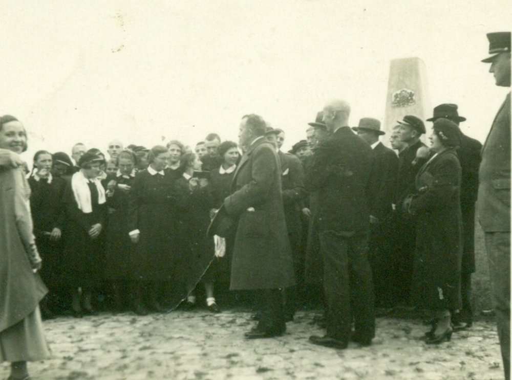
Photo from an excursion from Rokiškis to
Daugavpils in October 1935. Headmaster Mečislovas Kviklys of Rokiškis Gymnasium was holding a speach. Here we can see the Latvian concrete border
marker 2, 3. This photo is therefore
taken about 12 metres from the photo at the Lithuanian marker.
© Rokiškis Regional Museum.
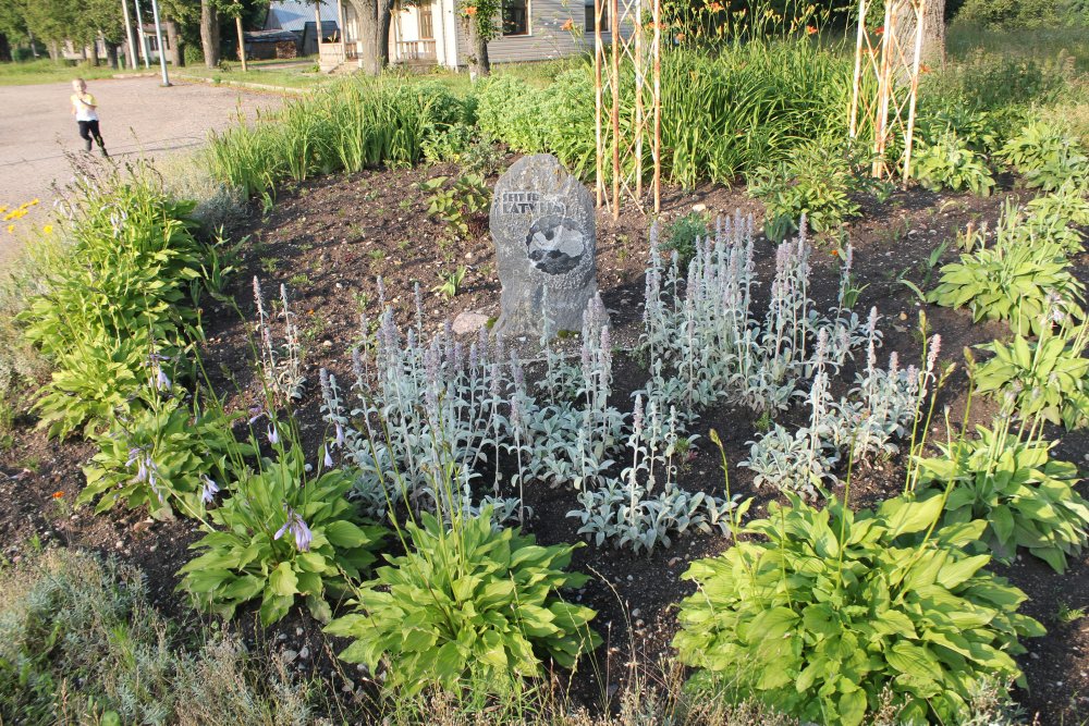
Right
inside the Latvian side of the border there was on the eastern road side a
nice welcome monument.

The
stone Šeit ir Latvija [Here is Latvia] with a map of the country
was projected by Mr. Imants Lukažs and stonemason Mr. Harijs Sprincis.

The
stone was located a few metres from border marker no. 1358.
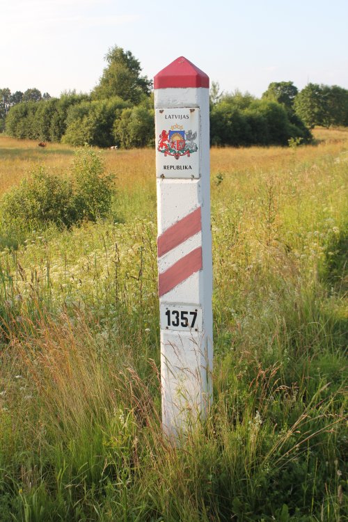
The
boundary changes slightly direction towards south at border marker no.
1357.

The
boundary same marker photographed from Latvian side.
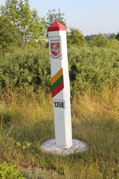
Boundary
marker 1358 and its foot clearly visible.
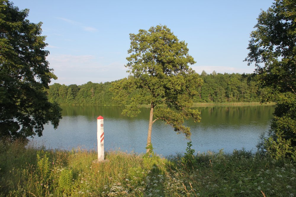
Further
east border marker no. 1359 was located near Lake Subate.
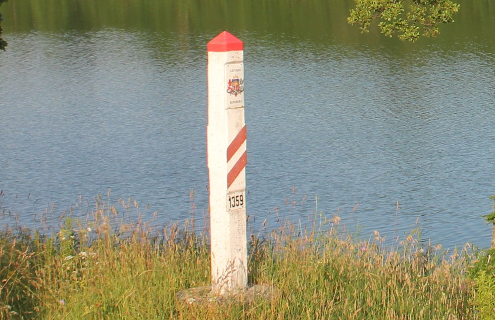
Cropped
image of the marker.

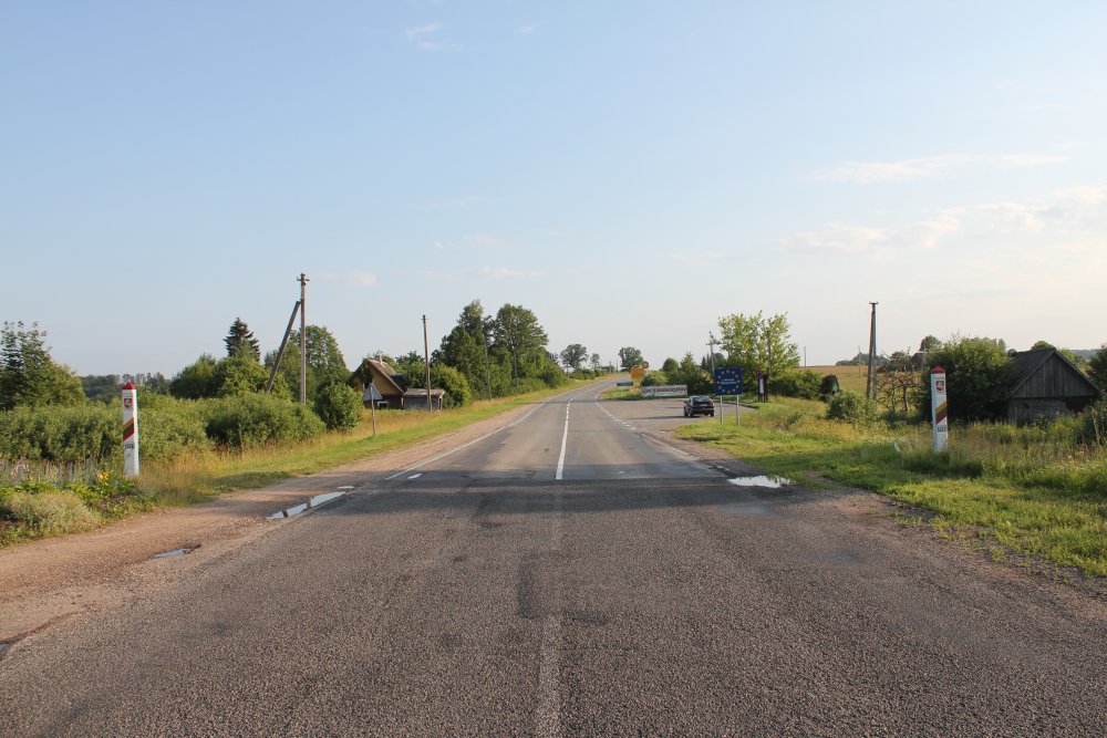
View
into Lithuania as seen from the borderline. Until Dec. 2007 the
Lithuanian control post was located at the rest area/bus stop where
the car is parked.
The
blue traffic sign informs we have entered Panevezys county and Rokiskis
municipality.

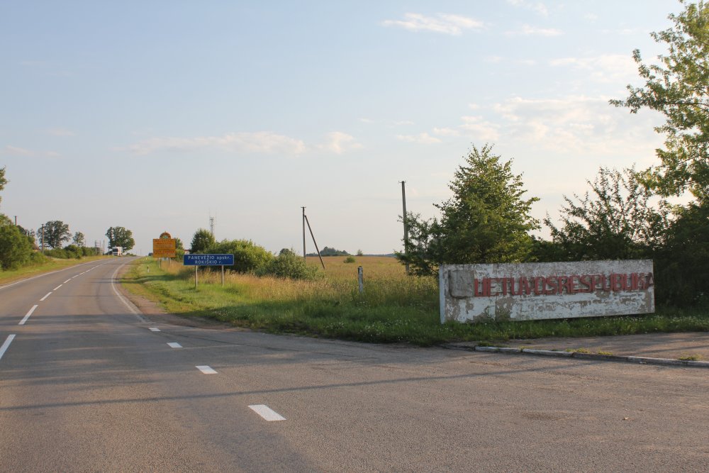
A
unique concrete sign possibly from the early 1990s with the text LIETUVOS
RESPUBLIKA [REPUBLIC OF LITHUANIA] was placed 100 m from the
borderline.

The
work was solid made.

The
Lithuanian coat of arms was of the pre-WW II type (with the horse tail
hanging down) used until 4 September 1991.

On
the opposite side of the road we found the possible remains of the
Lithuanian passport control booth.
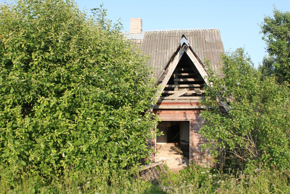
The
former border station was abandoned.