LTLV-1292-1293
Back ] Next ]


Up

Jan S. Krogh's Geosite: Latvia - Lithuania Boundary Points LTLV-1292 - 1293 (Juodupė, LT / Aknīste, LV)


The main road between Lithuania and until 1921 the Lithuanian town of Aknysta, presently the Latvian city of Aknīste.  After the 1918 independences of the Baltic countries there were several border adjustments.  The most important on the Latvian-Lithuanian boundary was the exchange of Lithuania's Aknysta against Latvia's town of Palanga. Here the border in direction towards Lithuania.  In the background a rest area which until 21 Dec 2007 was in use by the Lithuanian border control services.

And here towards north. Unpaved road on Latvian side.  

Direct 
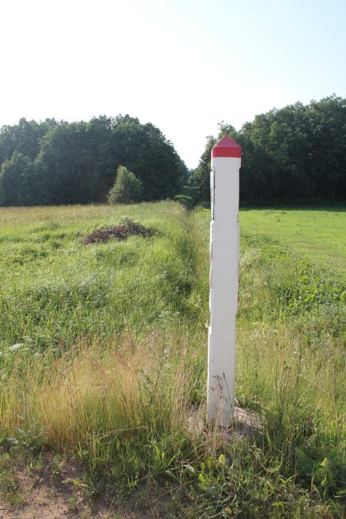
border marker 1292 from Latvian side.

The same border marker 1292 from Lithuanian side.

Direct border marker 1293 from Latvian side.

And the same border marker 1293 from Lithuanian side.

The boundary from marker 1292 and towards west. Lithuania to left and Latvia to right.

The boundary from marker 1293 and towards west. Lithuania to right and Latvia to left.

Present border map.  The Aknysta [Latvian; Aknīste] territory was until 30 March 1921 a part of Lithuania and became then together with other smaller Lithuanian border areas exchanged with the until then Latvian coast towns of Sventāja [Lithuanian: Šventoji] and Palanga.  A major reason for the border adjustment exactly here was the small ethnic Lithuanian population density in Aknysta. 

The points were visited in July 2012.

Sources and links

  1. Latvian-Lithuanian Boundary Treaty


This page was first time made on 16 September 2012. This page was last time updated 05/04/15 .