Jan S. Krogh's Geosite: Latvia - Lithuania
Boundary Points LTLV-1008-1009 (Salociai, LT / Grenctale, LV)
The
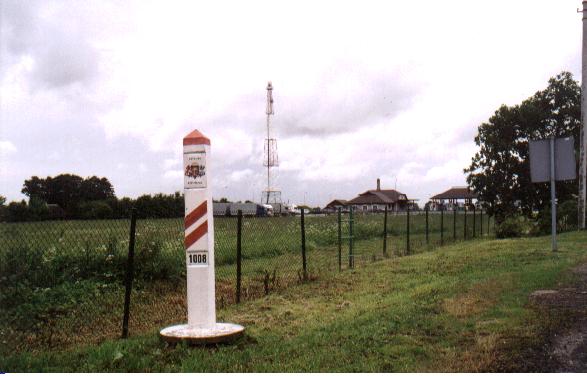
common LTLV boundary marker no. 1008 is located at Europe highway E75 where
Latvian highway A7 and Lithuanian highway A10 is meeting. The position is 56°
16' 28,632" N 24° 21' 54,9" E. You find it south of the common
Latvian and Lithuanian passport and customs control station which is located on
Latvian side.
Note
that the coat of arms are located inside the neighbouring country's territory
(the Lithuanian symbolism is located inside Latvian territory and visa versa).

LTLV bordermarker no. 1008 photographed from Latvian side into Lithuania.
You can see the Lithuanian coat of arms, flag colours and number 1008.
Behind is the road sign telling "Republic of Lithuania - Panevezys
County - Pasvalys Municipality". The point is located 24,6 km. north
of the town of Pasvalys.
(Photo of 23 Jun 2003.)