|
North
Korea – South Korea (KPKR) Border Maps
|
|
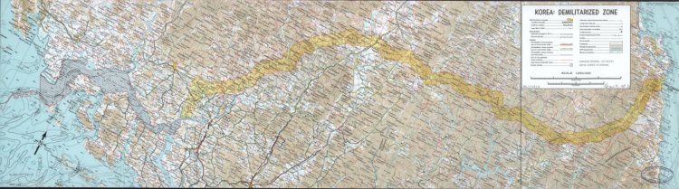
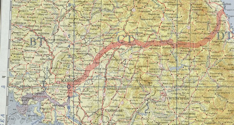
Full
1:250.000 DMZ map from 1969. (Click
on the image to get up a high-resolution image.) Source: Wikimedia. |
|
 A
1:1.000.000 DMZ USA Army map from 1964 over the DMZ/Korean boundary.
Source: Wikimedia. (Click
on the image to get up a high-resolution image.) |

Fragment
from the 1969 map showing the Joint Security Area. Source:
Wikimedia. |
|
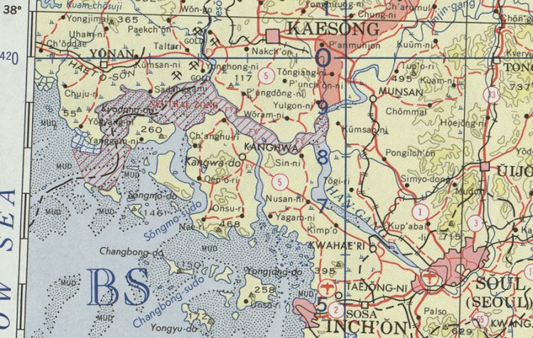
A
fragment from the 1964 map. Notice the neutral waters in the bay area.
Source: Wikimedia. |
|
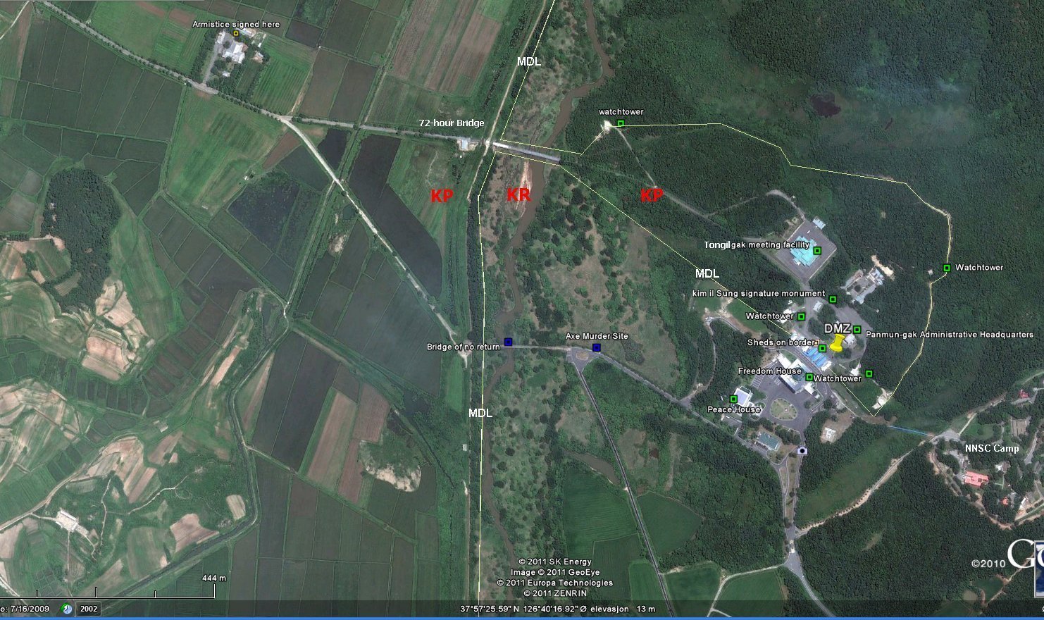
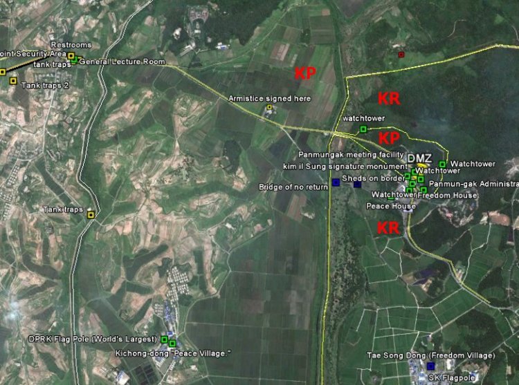
 JSA
region overview. The zone between the lines is the North Korean part of
the DMZ. The sourthern or eastern line represents the Military Demarcation
Line (MDL) which is a de facto North Korean - South Korean boundary. (Click
on the image to get up a high-resolution image.) |
|
|
Close-up
of the upper orthomap. We see that the Armistice building is located
inside the DMZ. |
|

The
Pyongyang - Seoul highway ends just before the North Korean JSA
information Center.
(Click
on the image to get up a high-resolution image.) |
|

The
North Korean JSA part of DMZ makes a semi-enclave only connected to the
rest of the North Korean DMZ by a 40 m wide and 130 long corridor. The
original Pyongyang - Seoul main road went over the Bridge of No
Return. Now it is only technically possible to drive through the JSA
over the 72-hour Bridge; as there are put road obstacles at the southern
bridge. The 72-hour Bridge got its name since it was built during 72 hours
after the Bridge of No Return incident.
(Click
on the image to get up a high-resolution image.) |
|
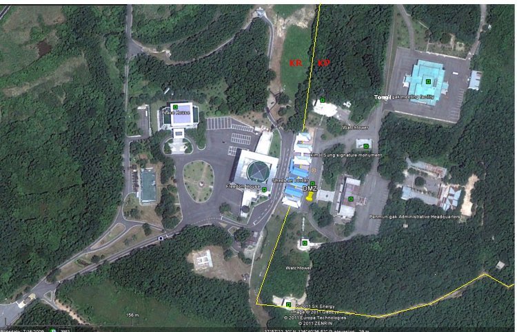
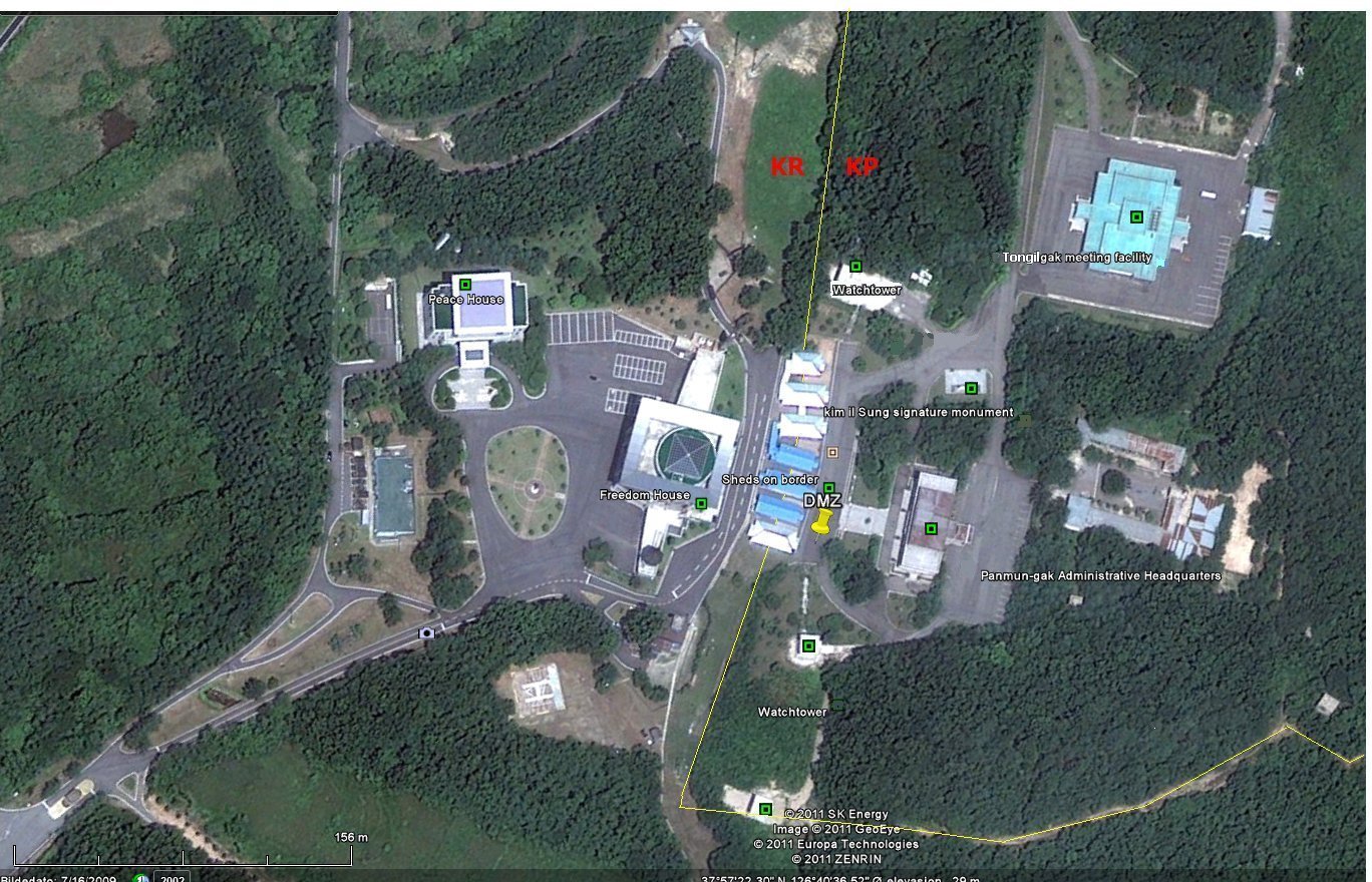
The
road between the countries goes over the Conference row; simply between
the buildings.
MDL position inside the most frequently used conference shed is 37°57'21"
N 126°40'37" E.
(Click
on the image to get up a high-resolution image.) |
|
|
Sources
and links:
1.
The forbidden railway: Vienna - Pyongyang: http://vienna-pyongyang.blogspot.com/2008/09/demilitarized-zone.html
|
|