|
France
– Monaco (FRMC): Blvd. Charles III (under construction)
The
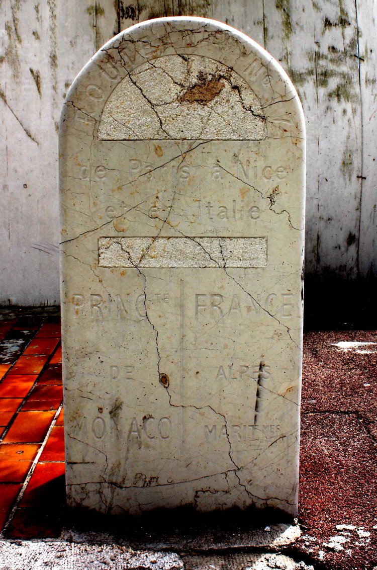
maybe most famous border marker between France and Monaco is in fact not a
border marker, but a road stone. It marks a point on the 7th route
Paris - Nice - Italy. |
|
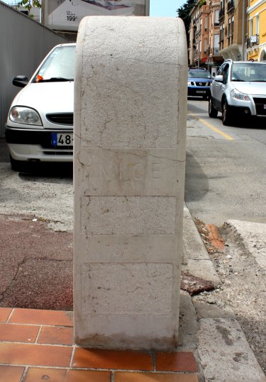
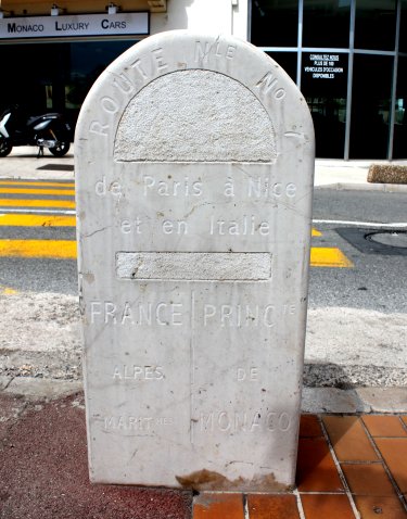 Towards
northwest: Route
Nle No 7 de Paris à Nice et en Italie. France
Alpes MarItmes | Princte de Monaco. |
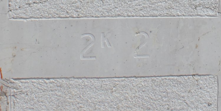
Towards
southwest: Nice and 18K 6 |
|
 Towards
southeast: Route
Nle No 7 de Paris à Nice et en Italie. Princte
de Monaco | France Alpes MarItmes |
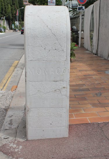
Towards
northeast:
Monaco
and 2K 2. |
|

Distance
to Nice: 18,600 metres. |
|
Distance to Monaco (Ville): 2,200 metres.

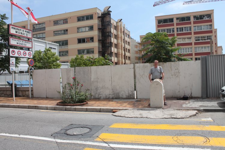
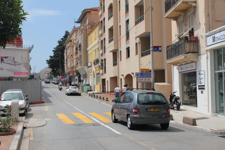
Photograped
across the Charles III Boulevard and towards northwest. Compared
with the tourist maps the stone appears to stand in a slightly incorrect
angle. According to the maps the boundary runs
further slightly east of the brown building. |
|
This
touristic welcoming stone is of a similar type as the Place
Antoine-Repaire stone. The coat of arms, texts and style are also
the same as the Blvd. du Jardin-Exotique column. This stone stands on the opposite side of the Monaco enter
signs, about 10 metres north of the boundary, and about 16 metres north of
the road stone. |
|
Route
no. 7 is in 2011 a highway route going from Paris via Nice to the
French-Italian border. |
|
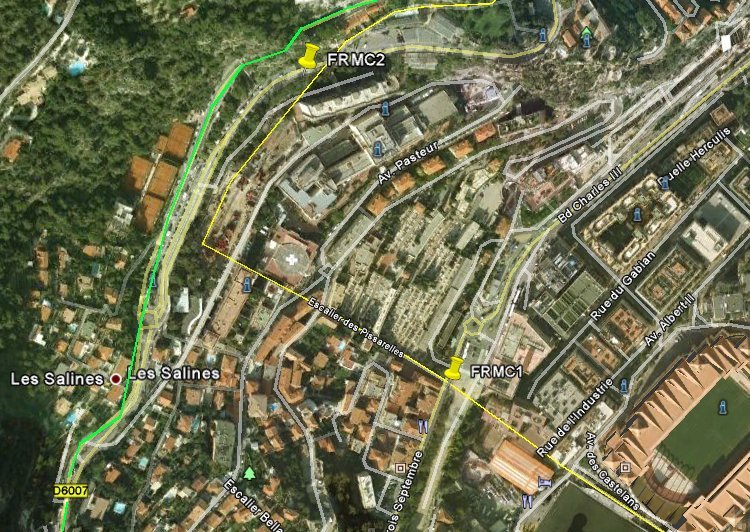
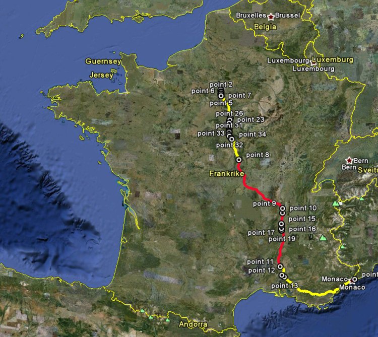
The
2011 Route no 7 is now following the green-marked road at road no D6007, and
is on its closest 325 metres away from where the Bvld. Charles III road
stone now stands (FRMC1).
When the road stone was put there Route no 7 was clearly going through
Blvd. Charles III and Monaco. |
|

But
further north Route no 7 passes through Monegasque territory – but only
on its northern lane – where France and Monaco shares a 85,5 metres long
boundary. |
|
|
View
from Monaco and southwest towards France. Note the road stone in the left
part of the picture. |
|
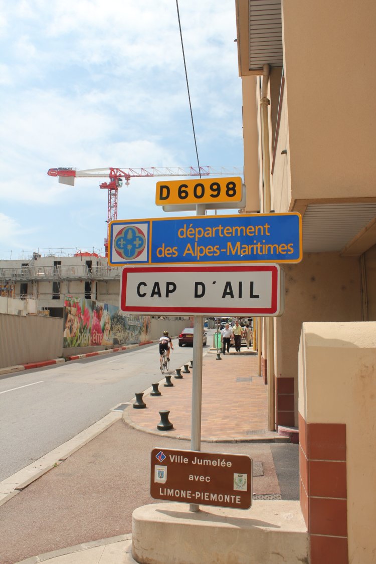
Entry
traffic sign to Cap d'Ail in the region of Aples-Maritimes. |
|