Marquain (B) - Baisieux (F)
border.
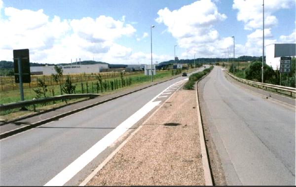
Photographed July 2001 from the assumed boundary
point, from south towards north towards the abandoned border station on
road A27.
(France is left and Belgium is right.)
This picture is taken from
behind the point where the picture above was taken. (Belgium is left,
and France right.)
I did not find any boundary marker, only a meeting point of two
different fences. The yellow marker belonged to the French Telekom.
A similar meeting point of two fences of same types I found on the
northern side of the border point.
Athus (B) - Mont-St.-Martin (F) border.
This picture is taken in July 2001 from Belgian side
towards south on Belgian road D830. To left is the Belgian traffic sign,
and equivalent French is visible in the right picture edge.
From this point on the same road to the Belgian - Luxembourg boundary is
only appr. 2 km! (See the Luxembourg page.)